
Table of Contents
In competitive exams, particularly in India, questions related to rivers hold the utmost importance as seen in the recent examination trend. Rivers constitute the lifelines of civilizations and play crucial roles in shaping geographical, environmental, and socio-economic landscapes. Understanding their routes, tributaries, Names, and Old Names and Mastering the knowledge of river-related questions not only enhances one’s grasp of India’s diverse geography but also will help you score good marks in the Competitive Examination. Those who are not preparing for any examination should also stay updated about the rivers of India.
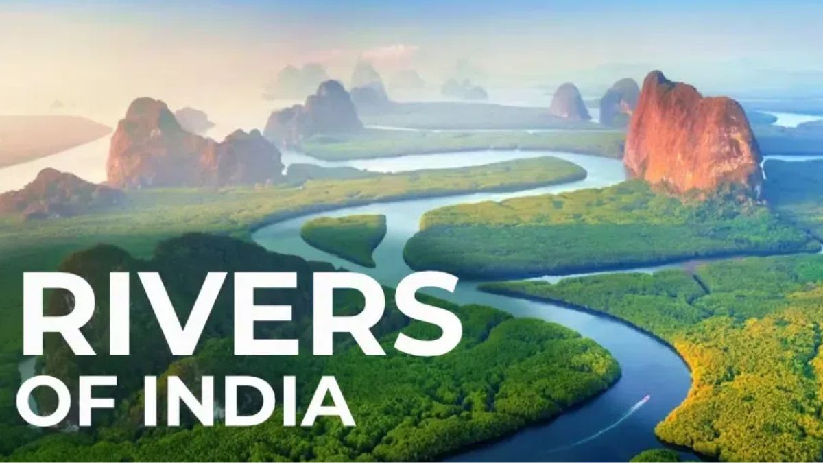
Rivers in India
Many rivers in India flow eastward towards the Bay of Bengal, while others flow westward into the Arabian Sea. In regions like the northern Aravalli range, parts of Ladakh, and the Thar Desert, some rivers have internal drainage and do not drain into the Sea. India’s major rivers originate from three key areas: the Himalayas and Karakoram range, the Chota Nagpur plateau along with the Vindhya and Satpura ranges, and the Western Ghats.
For candidates preparing for defense exams such as NDA, CDS, AFCAT, CISF, CRPF, Indian Army Agniveer, Airforce, MNS Recruitment, Territorial Army, and others, focusing on essential general knowledge topics is crucial. An important topic is the list of rivers, including their lengths, sources, and tributaries. Understanding these details is beneficial for exam preparation.
Indian River System
Let’s understand some major River Systems with the help of a table containing information about their length –
| Indian River System | ||
| River | Total length | Length in India |
| Indus | 3180 km | 1114 km |
| Brahmaputra | 2900 km | 916 km |
| Ganga | 2510 km | 2510 km |
| Yamuna | 1376 km | 1376 km |
| Narmada | 1312 km | 1312 km |
| Tapi | 724 km | 724 km |
| Godavari | 1465 km | 1465 km |
| Krishna | 1400 km | 1400 km |
| Cauvery | 805 km | 805 km |
| Mahanadi | 851 km | 851 km |

Indus River System
- The Indus River originates from the northern slopes of the Kailash range in Tibet near Lake Mansarovar.
- It flows northwestward from Tibet.
- The river spans approximately 2897 km with numerous tributaries in India and Pakistan.
- About 700 km of the Indus River flows through India.
- Upon entering Jammu and Kashmir, it forms a gorge.
- In the Kashmir region, it merges with tributaries like the Zaskar, Shyok, Nubra, and Hunza.
- The river passes through Ladakh, Baltistan, and Gilgit, navigating between the Ladakh and Zaskar ranges in Leh.
- It forms a 5181 m deep gorge near Attock, north of Nanga Parbat.
- Major Indian tributaries include the Jhelum, Ravi, Chenab, Beas, and Sutlej rivers.
Brahmaputra River System
The Brahmaputra originates from Mansarovar Lake, which is also a source of the Indus and Sutlej.
- The Brahmaputra River stretches for 3848 km, slightly longer than the Indus River.
- Most of its course lies beyond the borders of India.
- It flows alongside the Himalayas in an eastward direction. Upon reaching Namcha Barwa, it makes a U-turn around the mountain and enters India through Arunachal Pradesh.
- The river’s erosion depth is around 5500 meters.
- In India, it is called the Dihang River and flows through Arunachal Pradesh and Assam, receiving many tributaries along the way.
- In Assam, the Brahmaputra River has a braided channel for most of its length.
The river is known as the Tsangpo in Tibet. It receives less volume of water and has less silt in the Tibet region. But in India, the river passes through a region of heavy precipitation, and as such, the river carries large amounts of water during rainfall and a significant amount of silt. It is considered one of the largest rivers in India in terms of volume. It is known for creating calamities in Assam and Bangladesh.
You can also check the Complete List of Static General Knowledge
Ganga River System
The Ganga originates as the Bhagirathi from the Gangotri glacier.
- Before it reaches Devprayag in the Garhwal Division, the Mandakini, Pindar, Dhauliganga and Bishenganga rivers merge into the Alaknanda and the Bheling drain into the Bhagirathi.
- The Pindar River rises from East Trishul and Nanda Devi unites with the Alaknanda at Karan Prayag. The Mandakini meets at Rudraprayag.
- The water from both Bhagirathi and the Alaknanda flows in the name of the Ganga at Devprayag.
The concept of Panch Prayag
- Vishnuprayag: where the river Alaknanda meets river Dhauli Ganga
- Nandprayag: where river Alaknanda meets river Nandakini
- Karnaprayag: where river Alaknanda meets river Pinder
- Rudraprayag: where river Alaknanda meets river Mandakini
- Devprayag: where river Alaknanda meets river Bhagirathi -GANGA
The principal tributaries of the Ganga are Yamuna, Damodar, Sapta Kosi, Ram Ganga, Gomati, Ghaghara, and Son. The river after travelling a distance of 2525 km from its source meets the Bay of Bengal.
Yamuna River System
The Yamuna River is the largest tributary of the Ganga River.
- It starts from the Yamunotri glacier at the Bandarpoonch peak in Uttarakhand.
- Its main tributaries are the Sin, Hindon, Betwa, Ken, and Chambal rivers.
- The Tons is the largest tributary of the Yamuna.
- The river’s catchment area covers Delhi, Himachal Pradesh, Uttar Pradesh, Haryana, Rajasthan, and Madhya Pradesh.
Narmada River System
The Narmada is a river located in central India.
- Begins at the peak of Amarkantak Hill in Madhya Pradesh.
- Marks the historical boundary between North India and South India.
- One of the primary rivers in peninsular India, flowing from east to west.
- Passes through the states of Madhya Pradesh, Gujarat, and Maharashtra.
- Empties into the Arabian Sea in Gujarat’s Bharuch district.
Tapi River System
Tapi River is a central Indian river. It is one of the most important rivers of peninsular India with the run from east to west.
- It originates in the Eastern Satpura Range of southern Madhya Pradesh state.
- It flows in a westward direction, draining some important historic places like Madhya Pradesh’s Nimar region, East Vidarbha region and Maharashtra’s Khandesh in the northwest corner of the Deccan Plateau and South Gujarat before draining into the Gulf of Cambay of the Arabian Sea.
- The River Basin of Tapi River lies mostly in eastern and northern districts Maharashtra state.
- The river also covers some districts of Madhya Pradesh and Gujarat as well.
- The principal tributaries of Tapi River are Waghur River, Aner River, Girna River, Purna River, Panzara River and Bori River.
Godavari River System
The Godavari River is the second-longest course in India with brownish water which is about 1,450 km (900 miles) in length.
- The river is often referred to as the Dakshin (South) Ganga or Vriddh (Old) Ganga.
- It is a seasonal river, dried during the summers, and widens during the monsoons.
- This river originates from Trimbakeshwar, near Nasik in Maharashtra.
- It flows southeast across south-central India through the states of Madhya Pradesh, Telangana, Andhra Pradesh, and Orissa, and drains into the Bay of Bengal.
- The river splits into two streams thus forming a very fertile delta at Rajahmundry.
- The banks of this river have many pilgrimage sites, Nasik(MH), Bhadrachalam(TS), and Trimbak.
- Some of its tributaries include Pranahita (A combination of Penuganga and Warda), Indravati River, Bindusara, Sabari, and Manjira.
- Asia’s largest rail-cum-road bridge which is an engineering feat, links Kovvur and Rajahmundry is located on the river Godavari.
Krishna River System
Krishna is one of the longest rivers in India which is about 1300 km in length.
- It originates from Mahabaleshwar in Maharashtra.
- It flows through Sangli and meets the sea in the Bay of Bengal.
- The river flows through the states of Maharashtra, Karnataka, Telangana and Andhra Pradesh.
- Tungabhadra River is the main tributary which itself is formed by the Tunga and Bhadra rivers that originate in the Western Ghats.
- Dudhganga Rivers, Koyna, Bhima, Mallaprabha, Dindi, Ghataprabha, Warna, Yerla, and Musi are some of the other tributaries.
Cauvery River System
The Kaveri (also spelt Cauvery or Kavery) is one of the great rivers of India and is considered sacred by the Hindus.
- It originates from Talakaveri of Tamil Nadu, located in the Western Ghats about 5,000 feet (1,500 m) above sea level.
- The Kaveri is also known as Dakshin Ganga.
- It is a famous pilgrimage and tourist place in the Kodagu district of Karnataka.
- The headwaters of the river are in the Western Ghats range of Karnataka state, and from Karnataka through Tamil Nadu.
- The river drains into the Bay of Bengal. The river supports irrigation for agriculture and is considered as a means of support of the ancient kingdoms and modern cities of South India.
- The river has many tributaries called Arkavathy, Shimsha, Hemavati, Kapila, Shimsha, Honnuhole, Amaravati, Lakshmana Kabini, Lokapavani, Bhavani, Noyyal, and Tirtha.
Mahanadi River System
The Mahanadi is a river in eastern India. The Mahanadi rises in the Satpura Range of central India and flows east to the Bay of Bengal.
- The Mahanadi drains most of the state of Chhattisgarh and much of Orissa and also Jharkhand and Maharashtra.
Near the city of Sambalpur, a large dam – the Hirakud Dam – is built on the river. - The Mahanadi rises in the Satpura Range of central India and It has a length of around 860 km.
- It flows east to the Bay of Bengal. The river drains in the state of Maharashtra, Chhattisgarh, Jharkhand, and Orissa.
- The largest dam, the Hirakud Dam is built on the river.
Rivers in India, Their Lengths, Origins and Tributaries
The following list shows the names of rivers in India with their lengths, origins, and tributaries.
| S. No. | Rivers | Origin | Length (km) | End |
|---|---|---|---|---|
| 1. | Ganga | Gangotri Glacier (Bhagirathi), Uttarakhand | 2.525 | Bay of Bengal |
| 2. | Yamuna | Yamunotri Glacier, Uttarakhand | 1,376 | Merges with Ganga at Allahabad (Triveni Sangam – Kumbh Mela spot |
| 3. | Brahmaputra | Himalayan Glacier in Tibet, but enters India in Arunachal Pradesh | 1,800 | Merges with Ganga and ends in Bay of Bengal |
| 4. | Chambal | Tributary of Yamuna river, starting at Madhya Pradesh | 960 | Joins Yamuna river in UP |
| 5. | Son | Tributary of Ganga, starting at Amarkantak, Madhya Pradesh | 784 | Joins Ganga just above Patna – also considered part of Vindhya river system |
| 6. | Gandak | Nepal; Ganges tributary at Indo-Nepal border (Triveni Sangam) | 630 | Joins Ganga near Patna |
| 7. | Kosi | Starts from Bihar near Indo-Nepal border | 720 | Joins Ganga near Katihar district of Bihar |
| 8. | Betwa | Tributary of Yamuna, rises at Vindhya region, MP | 590 | Joins Yamuna at Hamirpur in UP |
| 9. | Gomti | Tributary of Ganga, starting at Gomat Taal, UP | 900 | Joins Ganga in Varanasi district |
| 10. | Ghaghara | Himalayan Glacier in Tibet, tributary of Ganga | 1080 | Joins Ganga in Bihar |
| 11. | Hugli (Hooghly) | Tributary of Ganga near West Bengal | 260 | Merges with Ganga at Bay of Bengal |
| 12. | Damodar | Tributary of Hugli near Chandwara, Jharkhand | 592 | Merges with Hugli in West Bengal |
| 13. | Mahananda | Paglajhora falls, Darjeeling, West Bengal | 360 | Merge in Ganga |
| 14. | Alaknanda | Satopanth & Bhagirathi-Kharak glacier | 190 | Merge in Ganga, Devprayag, Uttarakhand |
| 15. | Bhagirathi | Gaumukh, Uttarakhand | 205 | Merge in Ganga, Devprayag, Uttarakhand |
| 16. | Indus | Originates in Tibetan plateau, Enters India in J&K | 3180 | Merges into Arabian sea near Sindh |
| 17. | Chenab | Upper Himalayas in the Spiti district of Himachal Pradesh | 960 | Merges with Indus |
| 18. | Jhelum | Tributary of Chenab river, Punjab | 725 | Merges with Chenab at Jhang (Pakistan) |
| 19. | Ravi | Starts from Bara Bhangal, Kangra district, Himachal Pradesh | 720 | Joins Chenab in Pakistan |
| 20. | Sutlej | Tributary of Indus river, originates at Rakshastal, Tibet | 1500 | Meets Beas river in Pakistan and ends at Arabian sea |
| 21. | Beas | Rises at Himalayas in central Himachal Pradesh | 470 | Joins Sutlej river in Punjab, India |
| 22. | Parbati | Mantalai Glacier near Pin Prabati Pass | – | Mixes with Beas River at Bhuntar, near Kullu of Himachal Pradesh |
| 23. | Suru | Panzella Glacier, Pensi La Pass, Kargil | 185 | Indus, Nurla, Skardu, Pakistan |
| 24. | Dras | Machoi Glacier, Zoji La, ear Sonamarg, Jammu & Kashmir | 86 | Suru River at Kharul, Kargil |
| 25. | Zanskar | Doda River (First Branch), Kargyag and Tsarap River (Second Branch) | – | Indus River near Nimmu in Ladakh |
| 26. | Tsarap | Pankpo La, Sarchu | 182 | Zanskar River, Padum, Kargil |
| 27. | Doda | Drang-Drung Glacier, Pensi La | 79 | Zanskar River, Padum, Kargil |
| 28. | Kaveri | Talakaveri in Western Ghats in Karnataka | 765 | Ends in Bay of Bengal |
| 29. | Krishna | Originates in the Western Ghats near Mahabaleshwar in Maharashtra | 1400 | Ends in Bay of Bengal near Andhra Pradesh |
| 30. | Godavari | Starts in Maharashtra and passes through 7 Indian states | 1465 | Empties in Bay of Bengal |
| 31. | Tungabhadra | Tributary of Krishna river staring at Karnataka | 531 | Joins Krishna river along the border of Telangana and Andhra Pradesh |
| 32. | Tapti | Rises in Eastern Satpura Ranges, Madhya Pradesh | 724 | Empties into Gulf of Khambhat, Gujarat |
| 33. | Mahi | Rises in Madhya Pradesh | 580 | Flows into Arabian sea from Gujarat |
| 34. | Narmada | Starts from Amarkantak, Madhya Pradesh | 1315 | Drains into Arabian sea via Gulf of Cambay |
| 35. | Indravati | Dandakaranya range, Kalahandi district, Odisha | 535 | Godavari near border of Maharashtra, Chhattisgarh and Telangana |
| 36. | Pranhita | Confluence of Wardha and Wainganga, near Sirpur Kaghaznagar | 113 | Godavari, near Kaleshwaram, Telangana |
| 37. | Wardha | Satpura range, Multai, Betul district of Madhya Pradesh | 528 | Pranhita River |
| 38. | Kolab (Sabari) | Sinkaran hills, Koraput, Odisha | 200 | Godavari |
| 39. | Manjira | Balaghat hills | 724 | Godavari, near Kandakurthi, Karnataka |
| 40. | Wainganga | Satpura range, Mundara, Seoni district, Madhya Pradesh | 579 | Pranhita River |
| 41. | Painganga | Ajanta range, Aurangabad, Maharashtra | 676 | Wardha river, Chandrapur district, Maharashtra |
| 42. | Vedavathi | Confluence of Veda and Avathi | – | Tungabhadra river, near Siruguppa |
| 43. | Bhima | Bhimashankar | 861 | Krishna river, near raichur |
| 44. | Indrayani | Lonavala, Maharashtra | Bhima river | |
| 45. | Pavana | Sahyadri range, Lonavala Maharashtra | 58 | Mula river |
| 46. | Ghataprabha | Western ghats, Sindhudurg, Maharashtra | 283 | Krishna river, Almatti |
| 47. | Venna | Mahabaleshwar, Maharashtra | 130 | Krishna river, Satara, Maharashtra |
| 48. | Koyna | Mahabaleshwar, Maharashtra | 130 | Krishna river, near Karad, Satara |
| 49. | Amravati | Anamalai hills, Pambar, Chinnar rivers | 282 | Kaveri river at Karur, Tamil Nadu |
| 50. | Bhavani | Silent valley National Park, Kerala | 135 | Kaveri river at Kongu Nadu region of Tamil Nadu |
| 51. | Hemavati | Western Ghats, Chikmagalur, Karnataka | 245 | Kaveri river near Krishna Raja Sagara, Karnataka |
| 52. | Mahanadi | Dhamtari, Dandakaranya, Chhattisgarh | 858 | Bay of Bengal, near False Point, Kendrapara, Odisha |
| 53. | Subarnarekha | Chota Nagpur plateau, near Ranchi, Jharkhand | 395 | Kirtania Port, near Talsari, Bay of Bengal |
| 54. | Kangsabati | Chota Nagpur plateau, Purulia district, West Bengal | 465 | Bay of Bengal near Haldia |
| 55. | Penner (Penna) | Nandi Hills, Chikkaballapur district, Karnataka | 597 | Bay of Bengal, near Nellore, Andhra Pradesh |
| 56. | Palar | Nandi hills, Kolar district Karnataka | 348 | Bay of Bengal, near Vayalur, Tamil Nadu |
| 57. | Vaigai | Varusanadu Hills, Tamil Nadu | 258 | Palk Strait, Tamil Nadu |
| 58. | Vellar | Shevaroy Hills | 150 | Bay of Bengal, near Parangipettai, Tamil Nadu |
| 59. | Ponnaiyar | Nandidurg, Chikkaballapur | 400 | Bay of Bengal |
| 60. | Noyyal | Velliangiri Hills, Western Ghats, Tamil Nadu | 180 | Kaveri river |
| 61. | Gomai | Satpura Range | – | Tapti river, near Prakasha, Nandurbar, Maharashtra |
| 62. | Panzara | Near Pimpalaner, Dhule, Maharashtra | – | Tapti river |
| 63. | Purna | Satpura Range, Betul, Madhya Pradesh | – | Tapti river, near Changdev, Maharashtra |
| 64. | Kolar | Vindhya Range, near Sehore district, Madhya Pradesh | 101 | Narmada, near Raisen district of Madhya Pradesh |
| 65. | Tawa | Satpura Range, Betul, Madhya Pradesh | 172 | Narmada near Hoshangabad district |
| 66. | Sabarmati | Dhebar lake, Aravalli range, near Udaipur, Rajasthan | 371 | Gulf of Khambhat |
| 67. | Zuari | Hemad-Barshem in western ghats | 34 | Arabian sea |
| 68. | Ulhas | Near Rajmachi hills, Sahyadri range | 122 | Vasai creek, Mumbai |
| 69. | Mithi | Vihar lake and Powai lake | 15 | Arabian sea, Mahim creek, Mumbai |
| 70. | Mandovi | Bhimgad, Karnataka | 77 | Arabian sea |
| 71. | Kali | Kushavali, Karnataka | 184 | Arabian sea |
| 72. | Netravati | Kudremukh, Chikmagalur, Karnataka | – | Arabian sea, near Mangalore, Karnataka |
| 73. | Sharavati | Western Ghats, Tirthahalli, Karnataka | 128 | Arabian sea, near Honnavar, Uttar Kannada district, Karnataka |
| 74. | Periyar | Sivagiri hills, Sundaramala, Tamil Nadu | 244 | Lakshadweep Sea, Kerala |
| 75. | Bharathappuzha | Anamalai Hills, Tamil Nadu | 209 | Lakshadweep Sea, Ponnani, Kerala |
| 76. | Pamba | Pulachimalai Hills, Western Ghats | 176 | Vembanad Lake |
| 77. | Chaliyar | Elambaleri Hills, Western Ghats, Wayanad, Kerala | 169 | Lakshadweep Sea, Kerala |
Download the Complete PDF Here
Rivers of India Names with States
From the snow-capped peaks of the Himalayas to the fertile plains of the Indo-Gangetic basin, and the lush coastal regions, the rivers of India are the lifeblood of the nation, providing sustenance, livelihood, and a sense of belonging to the millions who call this land home. Check the State-wise list of Indian Rivers below –
| S. No. | State | Rivers |
| 1 | Andhra Pradesh | Godavari & Musi |
| 2 | Bihar | Ganga |
| 3 | Delhi | Yamuna |
| 4 | Goa | Mandovi |
| 5 | Gujarat | Sabarmati |
| 6 | Haryana | Yamuna |
| 7 | Jharkhand | Damodar, Ganga & Subarnarekha |
| 8 | Karnataka | Bhadra, Tungabhadra,Cauvery, Tunga & Pennar |
| 9 | Kerala | Pamba |
| 10 | Madhya Pradesh | Betwa, Tapti, Wainganga, Khan, Narmada, Kshipra, Beehar, Chambal & Mandakini. |
| 11 | Mahrashtra | Krishna, Godavari, Tapi and Panchganga |
| 12 | Nagaland | Diphu & Dhansiri |
| 13 | Orissa | Brahmini & Mahanadi |
| 14 | Punjab | Satluj |
| 15 | Rajasthan | Chambal |
| 16 | Sikkim | Rani Chu |
| 17 | Tamil Nadu | Cauvery, Adyar, Cooum, Vennar, Vaigai & Tambarani |
| 18 | Uttar Pradesh | Yamuna, Ganga & Gomti |
| 19 | Uttranchal | Ganga |
| 20 | West Bengal | Ganga, Damodar & Mahananda |
Longest Rivers of India
Given below is the list of the longest rivers in India along with their length –
| S. No. | River | Length in India (km) | Total Length (km) |
| 1. | Ganga | 2525 | 2525 |
| 2. | Godavari | 1464 | 1465 |
| 3. | Krishna | 1400 | 1400 |
| 4. | Yamuna | 1376 | 1376 |
| 5. | Narmada | 1312 | 1312 |
| 6. | Indus | 1114 | 3180 |
| 7. | Brahmaputra | 916 | 2900 |
| 8. | Mahanadi | 890 | 890 |
| 9. | Kaveri | 800 | 800 |
| 10. | Tapti | 724 | 724 |
Ancient and New Names of River
In the recent examination trend, the Ancient and New River names questions are asked. We have provided the list of rivers with their new names.
| Ancient Names | Modern Names |
| Kubhu | Kurram |
| Kubha | Kabul |
| Vitastata | Jhelum |
| Askini | Chenab |
| Purushni | Ravi |
| Shatudri | Satluj |
| Vipasha | Beas |
| Sadanira | Gandak |
| Drishdvati | Ghaghara |
| Gomti | Gomal |
| Suwastu | Swat |
| Indus | Indus |
| Saraswati / Drishtwarti | Ghaghar/ Rakshi/ Chittag |
| Sushoma | Sohan |
| Marudvridha | Maruvarman |
East Flowing Rivers in India
The East Flowing Rivers are those River which drains into the Bay of Bengal. Here is a list of all the major East flowing rivers in India:
- Subarnarekha River
- Krishna River
- Godavari River
- Mahanadi River
- Damodar River
- Ponnaiyar River
- Kaveri River
- Sarada River
- Vaigai River
- Pennar River
- Brahmani River
West Flowing Rivers in India
West Flowing Rivers are those rivers which drains into the Arabian sea. Here is the list of West flowing rivers in India.
| River | Origin (State) | Total Length (km) |
| Narmada (Reva River) | Madhya Pradesh | 1,310 |
| Tapti/Tapi River | Madhya Pradesh | 724 |
| Mahi River | Madhya Pradesh | 583 |
| Sabarmati River | Rajasthan | 371 |
| Luni (Salt River) | Rajasthan | 495 |
| Tawa River | Madhya Pradesh | 117 |
| Sharavati River | Karnataka | 128 |
Rivers of India Importance
India has many rivers, with the Ganges being the largest and the Arvari River the smallest. Rivers of India are necessary for agriculture, providing water for irrigation and drinking. They are also used for transportation, hydroelectric power generation, and industry. The Ganges holds religious significance, while the Brahmaputra is known for its fertile plains. Understanding India’s rivers is essential for appreciating their role in the country’s economy and culture.


 Important Topics to Score 300+ in NDA GA...
 CDS Exam Pattern 2025, OTA, IMA, INA and...
 Indian Coast Guard Navik Selection Proce...