Table of Contents
Himalayas 2021: Relevance
GS 1: Distribution of key natural resources across the world (including South Asia and the Indian sub-continent).
Physical Features of India
- India’s physical features can majorly be divided into 6 parts:
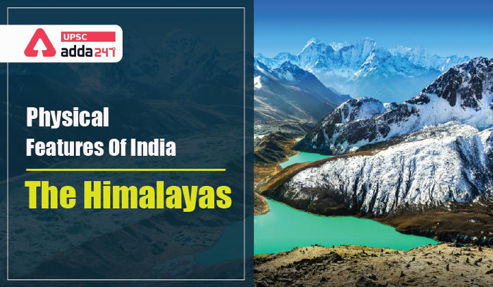
- The Northern and North-eastern Mountains
- The Northern Plain
- The Peninsular Plateau
- The Indian Desert
- The Coastal Plains
- The Islands.
- In this article, we will restrict our discussion to The Northern and North-eastern Mountains, which are part of Himalayan range of mountains.
Himalayas 2021
- The Himalayas are the highest and the youngest fold mountain ranges of the world.
- Geologically, the Himalayas are young, weak and flexible because its uplift is an ongoing process.
- This distinctive feature makes it one of the most earthquake-prone regions of the world.

Himalayas 2021: Formation of Himalayas
- The Himalayas have been formed over 50 million years ago when Indian plate collided with the Eurasian plate.
- As the density of Indian plate was higher, the Indian plate slid below the Eurasian plate.
- It led to crumbling and buckling up the Eurasian plate into the various mountain ranges that are now a part of the Himalayas.
Himalayas 2021: Himalayan ranges
- The Himalayas consist of a series of parallel mountain ranges.
- Some of the important ranges are the Greater Himalayan range, which includes the Great Himalayas and the Shiwalik.
Himalayas 2021: Orientation of Himalayas
- The general orientation of these ranges is from northwest to the southeast direction in the northwestern part of India.
- Himalayas in the Darjiling and Sikkim regions lie in an eastwest direction, while in Arunachal Pradesh they are from southwest to the northwest direction.
- In Nagaland, Manipur and Mizoram, they are in the northsouth direction.

Himalayas 2021: Himalayas Significance
- The Himalayas stand like a strong and long wall between the Indian subcontinent and the Central and East Asian countries.
- Himalayas are not only the physical barrier, they are also a climatic, drainage and cultural divide.
Himalayas 2021: Himalayas sub-division
On the basis of relief, alignment of ranges and other geo-morphological features, the Himalayas can be divided into the following sub-divisions:
Kashmir or Northwestern Himalayas
- The Kashmir Himalayas are famous for Karewa formations, which are useful for the cultivation of Zafran, a local variety of saffron
- Ranges: Karakoram, Ladakh, Zaskar and Pir Panjal.
- Important passes: Zoji La on the Great Himalayas, Banihal on the Pir Panjal, Photu La on the Zaskar and Khardung La on the Ladakh range.
- Important lakes: Fresh lakes such as Dal and Wular and salt water lakes such as Pangong Tso and Tso Moriri.
- Meandering of Jhelum: Jhelum, despite being in youth stage, forms meanders because of the local base level provided by the erstwhile larger lake of which the present Dal Lake is a small part.
Himachal and Uttarakhand Himalayas
- This part lies approximately between the Ravi in the west and the Kali (a tributary of Ghaghara) in the east
- It is drained by two major river systems of India—the Indus and the Ganga.
- The northernmost part of the Himachal Himalayas is an extension of the Ladakh cold desert, which lies in the Spiti subdivision of district Lahul and Spiti.
- In the Great Himalayan range, the valleys are mostly inhabited by the Bhotia’s.
- Bhotia’s are nomadic groups who migrate to ‘Bugyals’ (the summer glasslands in the higher reaches) during summer months and return to the valleys during winters.
- Important destinations: ‘Valley of flowers’, Gangotri, Yamunotri, Kedarnath, Badrinath and Hemkund Sahib.
Darjiling and Sikkim Himalayas
- They are flanked by Nepal Himalayas in the west and Bhutan Himalayas in the east.
- It is a region of high mountain peaks like Kanchenjunga (Kanchengiri),fast-flowing rivers like Teesta and deep valleys.
- Duar formation: They have also been used for the development of tea gardens.
Arunachal Himalayas
- These extend from the east of the Bhutan Himalayas up to the Diphu pass in the east.
- Important mountain peaks: Kangtu and Namcha Barwa.
- Important rivers: Kameng, the Subansiri, the Dihang, the Dibang and the Lohit.
- These are perennial with the high rate of fall, thus, having the highest hydro-electric power potential in the country.
Eastern Hills and Mountains
- These are part of the Himalayan Mountain system having their general alignment from the north to the south direction.
- Jhum cultivation: The tribals living in the lowlands practice shifting cultivation that is locally called as Jhum cultivation.
- Loktak Lake: The physiography of Manipur is unique by the presence of a large lake known as ‘Loktak’ lake at the centre, surrounded by mountains from all sides.
- Molassis basin: Mizoram is also known as the ‘Molassis basin’ because it is made up of soft unconsolidated deposits.
Also Read:
 TSPSC Group 1 Question Paper 2024, Downl...
 TSPSC Group 1 Answer key 2024 Out, Downl...
 Cabinet Ministers of India 2024, New Cab...