
Table of Contents
The Northern Plains: Relevance
- GS 1: Distribution of key natural resources across the world
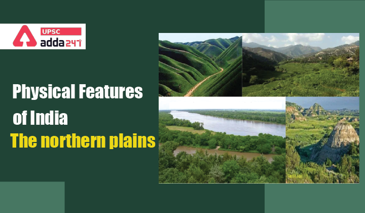
Physical Features of India
- India’s physical features can majorly be divided into 6 parts:
- The Northern and North-eastern Mountains
- The Northern Plain
- The Peninsular Plateau
- The Indian Desert
- The Coastal Plains
- The Islands.
- In the last article, we discussed about Himalayas comprehensively. In this article, we will discuss about The Northern plains.
Northern Plains location
- They lie to the south of the Shivaliks, and are separated by the Himalayan Frontal Fault (HFF).
- The southern boundary of the northern plains is a wavy irregular line along the northern edge of the Peninsular India.
- On the eastern side, the northern plains are bordered by the Purvanchal hills.

Northern Plains characteristics
- Northern plains are the youngest physiographic feature of India.
- They are formed by the alluvial deposits brought by three rivers – the Indus, the Ganga and the Brahmaputra.
- It makes the northern plains the largest alluvial tract of the world.
- These plains extend approximately 3,200 km from the east to the west.
- The average width of these plains varies between 150-300 km. The maximum depth of alluvium deposits varies between 1,000-2,000 m.
Northern Plains division
- From the north to the south, these plains can be divided into three major zones: the Bhabar, the Tarai and the alluvial plains. The alluvial plains can be further divided into the Khadar and the Bhangar.
Bhabhar
- Bhabar is a narrow belt ranging between 8-10 km parallel to the Shiwalik foothills at the break-up of the slope.
- As a result of this, the streams and rivers coming from the mountains (Indus and Teesta) deposit heavy materials of rocks and boulders, and at times, disappear in this zone.
- The area is characterized by dry river courses except in the rainy season as most of the streams sink and flow underground due to the presence of porous pebble-studded rock beds.
- The Bhabar tract is not suitable for cultivation of crops. However, big trees with large roots thrive in this region.
- The Bhabar belt is narrower in the east than the western and north-western hilly region.
Tarai
- South of the Bhabar is the Tarai belt, with an approximate width of 10-20 km.
- Here most of the streams and rivers re-emerge without having any properly demarcated channel, thereby, creating marshy and swampy conditions known as the Tarai.
- This region has a luxurious growth of natural vegetation and houses a varied wildlife.
- There areas were once covered with dense forests, however, today most of the Tarai land (especially in Punjab, Uttar Pradesh and Uttarakhand) has been reclaimed and turned into agricultural land.

Alluvial Plains
- The south of Tarai is a belt consisting of old and new alluvial deposits known as the Bhangar and Khadar respectively.
- These plains have characteristic features of mature stage of fluvial erosional and depositional landforms such as sand bars, meanders, oxbow lakes and braided channels.
- Here, mouths of the rivers (Ganga and Brahmaputra) form some of the largest deltas of the world, for example, the famous Sunderbans delta.
- The states of Haryana and Delhi form a water divide between the Indus and the Ganga River systems.
- Brahmaputra Plains: These are known for their riverine islands and sand bars. Most of these areas are subjected to periodic floods and shifting river courses forming braided streams.
- The Brahmaputra River, flows from the northeast to the southwest direction before taking an almost 90° southward turn at Dhubri before it enters into Bangladesh.
- These river valley plains have a fertile alluvial soil cover which supports a variety of crops like wheat, rice, sugarcane and jute, and hence, supports a large population
Bhangar
- Bhangar is the older alluvium that are formed along the river beds, thus forming terraces higher than the flood plain.
- They are dark in colour due to the presence of humus content, and are also productive.
- The soil here is clayey in and has lime modules, also called kankar nodules.
- Kankar or kunkur is a sedimentological term, occasionally applied to detrital or residual rolled, often nodular calcium carbonate formed in soils of semi-arid regions.
- They are usually found in the doabs.
- Regional variations: The Barind plains’ in the deltaic region of Bengal and the ‘bhur formations’ in the middle Ganga and Yamuna doab.
Khadar
- Khadar is composed of newer alluvium and forms the flood plains along the river banks.
- These are found near the riverbeds, and are light in colour, sandy in texture and more porous than bhangar.
- It the most fertile region of Ganger water system owing to the fact that a new layer of alluvium is deposited by river flood almost every year.
- In Punjab, these floodplains are locally known as ‘Betlands’ or ‘Bets’.
Also Read:


 TSPSC Group 1 Question Paper 2024, Downl...
 TSPSC Group 1 Answer key 2024 Out, Downl...
 UPSC Prelims 2024 Question Paper, Downlo...
