
Table of Contents
There are currently 8 union territories of india. Jammu and Kashmir has been transformed from a sovereign state to a union territory. After being divided from Jammu & Kashmir, Ladakh was established as an additional union territory. October 31, 2019, was the date of implementation.
On January 26, 2020, the two separate union territories of “Daman and Diu” and “Dadra and Nagar Haveli” were united to form the Union Territory of Dadra and Nagar Haveli and Daman and Diu. There are currently eight union territories as a result. Scroll down to learn more about Union Territories of India.
What are the Union Territories of India?
- Direct Administration: The Indian Central Government has direct control over the Union Territories (UTs).
- Governance: A Lieutenant Governor or an Administrator nominated by the Indian President is in charge of overseeing them.
- Examples include the Andaman and Nicobar Islands, Dadra and Nagar Haveli, Daman and Diu, Lakshadweep, Chandigarh, Delhi, and Puducherry. Designed for security, cultural management, or efficient small-area administration.
- Legislative Authority: Several Union Territories (UTs), such as Delhi and Puducherry, possess a legislature with restricted authority, especially concerning law and order issues.
Union Territories of India
Largest Union Territory of India
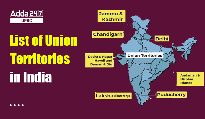
Total Union Territories in India: India has 8 Union Territories (ut of India).
List of 8 Union Territories of India
The Union Territories of India (ut of India) are listed in detail in the table below, along with the years in which each was established. The Biggest Union Territories of India have a special place in the national administrative structure.
| List of Union Territories of India | ||
| Sr. No. | Union Territory |
Year of Formation
|
| 1. |
Andaman and Nicobar Islands
|
1956 |
| 2. | Chandigarh | 1966 |
| 3. |
Dadra and Nagar Haveli and Daman and Diu
|
2020 |
| 4. | Lakshadweep | 1956 |
| 5. | Delhi | 1956 |
| 6. | Puducherry | 1964 |
| 7. | Ladakh | 2019 |
| 8. |
Jammu and Kashmir
|
2019 |
List Union Territories of India Geography
Over here we have mentioned Indian Union Territories (ut of india) that are covered in detail. These points are also can be helpful for the UPSC Examination.
- The Andaman and Nicobar Islands are made up of more than 570 islands and are situated in the Bay of Bengal. The islands are well-liked as tourist destinations because of their breathtaking scenery. There are numerous tribes in the area, and the islands host a sizable naval installation.
- Both Punjab and Haryana have Chandigarh as their capital. Chandigarh is a union territory under central administration. Acknowledgable for its planned architecture and urban planning, it is a center for business, culture, and education.
- In 2020, Dadra and Nagar Haveli and Daman and Diu, two separate territories, merged into one. Situated on the western coast of India, these regions are widely recognized for their historical significance and beautiful scenery.
- The island group known as Lakshadweep is located in the Arabian Sea. It’s well-known for having a lot of biodiversity, white sand beaches, and coral reefs. The people living there come from a wide variety of ethnic backgrounds, and the region has its own unique cultural identity.
- Delhi, the capital of India, is a union territory governed by an elected legislature. It is well-known for its rich history, many cultures, and standing as a center for politics, business, and education.
- Known also as Puducherry, Pondicherry was once a French colony and is known for its unique blend of Indian and French cultures. The beaches, French cuisine, and stunning architecture of this place are well-known.
- Jammu and Kashmir’s state included both Jammu and Kashmir and Ladakh until it was split into two separate union territories in 2019. The natural beauty and rich cultural past of Jammu and Kashmir are well-known, whereas the rough landscape, snow-capped mountains, and unique culture of Ladakh are well-known.
Andaman and Nicobar Islands
The Andaman and Nicobar Islands are located in the Bay of Bengal, stretching from Myanmar’s southern border to Indonesia’s northern border. The capital and main city is Port Blair, which is also the administrative center. It is one of the largest Union Territories in India, covering over 8,249 square kilometers, with a population of around 4 lakh.
The islands are home to several tribes, including indigenous groups. People speak various languages such as Bengali, Tamil, Malayalam, Telugu, Hindi, and Nicobarese. The Andaman and Nicobar Islands are famous for their stunning landscapes, forests, beaches, marine life, and religious sites, making it a popular tourist destination.

Union Territory of Chandigarh
A Union Territory in India, Chandigarh is well known for its modern infrastructure and unique urban design. Chandigarh, the capital of Punjab and Haryana, is a vibrant city that skillfully combines architectural talent with the natural world. The city, which was planned by the famous architect Le Corbusier, is separated into organized areas, each with its green areas and facilities.

Dadra and Nagar Haveli and Daman and Diu
By combining Daman and Diu with Dadra and Nagar Haveli, the Indian government created a new union territory. Its influence was greatest from 1954 to 1961 when it was referred to as the “Free Dadra and Nagar Haveli Administration.” In addition to having the same powers as other Union Territories, these areas are managed by administrators selected by the Central Government and enjoy the special status of governors.
The capital of Dadra and Nagar Haveli is Silvassa; the capital of Daman and Diu is Daman. These union territories are primarily home to speakers of Gujarati and Hindi, and the rituals, festivals, and local way of life display a current version of Indian culture.

Union Territory of Lakshadweep
India’s Lakshadweep state is a set of states in the Arabian Sea and Lakshadweep is latest area of Indian Union Territory. The language spoken here is Malayalam, however, island dialects like Jeseri and Mahal are also spoken. The archipelago consists of 36 islands, only 11 of which are inhabited. The capital is Kavaratti. Lakshadweep is home to 64,429 people and has a land area of around 32 square kilometers. Its primary industries include shipbuilding, fishing, tourism, and palm oil cultivation. Lakshadweep is renowned for its flawless beaches, marine life, and beautiful surroundings.

Union Territory of Delhi
Delhi, the capital of India, is located on the Indian subcontinent. It is an important city with the highest population in India. With a land area of 1,483 square kilometers, Delhi is home to around 1,67,53,235 people. In India, Delhi has great cultural and historical significance. It is considered as an important religious and tourist destination because of its many administrative structures, historical sites, temples, mosques, domes, and majestic government buildings.
The main languages spoken in Delhi are English, Hindi, Punjabi, and Urdu. In terms of organization and variety, the residents are a bilingual, multi-ethnic community. Delhi is a major center for trade and events, where people from diverse languages, religions, and cultures live side by side.

Union Territory of Puducherry
This state’s capital, Puducherry, is a well-liked travel destination. Puducherry’s diverse culture, long history, and beautiful landscape make it a popular destination. Puducherry is home to around 12,44,464 people and has a land area of 479 square kilometers. The state’s languages, which are widely spoken and understood, are English, French, Malayalam, Tamil, and Telugu.
The cultural legacy of Puducherry has also been influenced by the languages of Tamil and French. Puducherry has historically been a part of France for a very long period. It is clear how both have been influenced by French architecture and culture.

Jammu and Kashmir and Ladakh
Jammu & Kashmir became a union territory on October 31, 2019, and it ceased to be a state. Ladakh became its own union region after severing from Jammu and Kashmir. The capital of Jammu and Kashmir during the winter is Jammu. Jammu and Kashmir’s summer capital is Srinagar. The literacy rate in the union territory is 67.16%.
The four languages that are most often used in the union territory of Jammu and Kashmir are Hindi, English, Dogri, and Kashmiri. The primary driver of the economy in Jammu & Kashmir is agriculture. J&K is a major exporter of saffron, walnuts, pears, cherries, plums, and apples. Kishtwar is known as the “land of sapphire and saffron” in Jammu and Kashmir.

Andaman and Nicobar
The Andaman and Nicobar Islands are a collection of Indian Union territories that are situated in the Bay of Bengal. These islands are well-known for their vibrant marine life, beautiful beaches, and uncommon beauty. There are 572 islands in the 8,073 square kilometer Andaman and Nicobar Islands, of which just 38 are inhabited.
These islands have a long history; the first documented human settlers are said to have arrived on the islands around 26,000 years ago. Before the British seized control of the islands in the eighteenth century, they were ruled by many kingdoms, notably the Chola dynasty and the Maratha Empire.
Chandigarh
Chandigarh is the joint capital of Punjab and Haryana as well as an Indian union territory. English is the official language of Chandigarh. The majority of people speak Hindi, which is followed by Punjabi. Chandigarh has earned the nickname “Pensioner’s Paradise”. Various esteemed institutions for learning, including elite universities, can be found in Chandigarh.
Chandigarh’s architecture and urban design are highly regarded. One of the earliest planned cities in post-independence India was Chandigarh. It was designed by Swiss-French architect Le Corbusier. The Chandigarh capitol complex was recognized as a World Heritage Site by UNESCO in 2016.
Dadra and Nagar Haveli and Daman and Diu
Two union territories in western India are Dadra and Nagar Haveli and Daman and Diu. On January 26, 2020, they merged to become one entity. The states of Maharashtra to the south and Gujarat to the north border the union territory. These union areas are small, but they have a distinct history, culture, and set of attractions.
Before being set free by the Indian government in 1954, Dadra and Nagar Haveli were ruled by the Portuguese for more than four centuries. In the same way, Daman and Diu were ruled by the Portuguese until 1961, when India annexed them. On January 26, 2020, the two regions united to form a single union territory.
Puducherry
Except from its eastern boundary, Tamil Nadu encircles Puducherry, which is located on the country’s east coast. Puducherry’s culture and architecture are inspired by its history as a French colony, which lasted until 1954.
Visitors from all over the world visit Puducherry, a well-liked vacation resort. Rich cultural legacy, beautiful scenery, and beautiful shores are some of its best-known features. Temples, churches, and ashrams flourish in this city, which is also well-known for its spiritual and religious significance.
Ladakh
The capital of Ladakh is Leh. Leh is the largest town in Ladakh. The second-biggest town in Ladakh is called Kargil. The popular Sutta, Indus, and Shyok river basins are located in Ladakh. With the passage of the Jammu and Kashmir Reorganisation Act by the Indian government in 2019, Ladakh was split up into a separate union region. Muslims comprise 46% of the population of Ladakh, which is the majority.
The following are Ladakh’s demographics: 40% are Buddhists, and 12% are Hindus. The Indian state of Himachal Pradesh lies to the south, the Tibet Autonomous Region lies to the east, and Jammu and Kashmir, a union territory, lies to the east.
| Related Articles | |
| Union Budget 2024 | |
| Brahmaputra River System | |
| Rig Vedic Gods | |


 TSPSC Group 1 Question Paper 2024, Downl...
 TSPSC Group 1 Answer key 2024 Out, Downl...
 UPSC Prelims 2024 Question Paper, Downlo...
