
Table of Contents
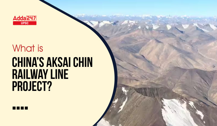
What Is Aksai Chin Railway Line Project?
In this article, Aksai Chin Railway Line Project, we will discuss about China’s Aksai Chin Railway Line Project, India’s Strategic Railway Line Plan Along India-China Border, India’s Position On Aksai Chin, etc.
Context of Aksai Chin Railway Line Project
In News?
China’s government recently unveiled the plans to expand its railway network in the Tibet region that will pass through Aksai Chin(part of the Indian state of Jammu and Kashmir under illegal Chinese occupation).
Background
India and China remain locked in an evolving military standoff across the Line of Actual Control (LAC) in eastern Ladakh (region with contiguous boundary with Aksai Chin), since June 2020.
China’s Aksai Chin Railway Line Project In Response to India’s strategic lines?
- China’s Aksai Chin Railway Line Project has most probably come in response to India’s unveiling of the Detailed Project Reports (DPRs) to expeditiously construct four “strategic lines” of railway along the disputed boundary with China.
- As, after India expedited the construction of four “strategic lines” of railways near its disputed boundary with China, the Beijing-controlled Tibet Autonomous Region Development and Reform Commission revealed that the expansion of railway network will be expanded by 2,641 km by 2025 which will pass through the contentious Aksai Chin region close to the Line of Actual Control with India.
Pralay For China – India To Deploy Tactical Ballistic Missiles Along LAC
India’s Strategic Railway Line Plan Along India-China Border?
- Recently, India has expedited its efforts in constructing strategic railway lines near the Line of Actual Control with China and has already released the detailed project reports (DPR) of these lines.
- India will have a total railway network of about 1,352 km near the Line of Actual Control (in the country’s north) and the McMahon Line (in the country’s northeast) it shares with China.
- India has unveiled four proposed railway lines, three in the Northeast and one in the North.
- India’s proposed Bhanupli-Bilaspur-Manali-Leh line, once opened, will be the world’s highest railway line, overtaking China’s Qinghai-Tibet line.
- The other three railway lines are links to the border in the northeastern state of Arunachal Pradesh: Missamari-Tenga-Tawang (378 km); Pasighat-Tezu-Rupai (227 km); North Lakhimpur-Bame-Silapathar (249 km).
Important Facts
|
Strategic Importance Of Siyom Bridge To Tackle China
What Is Aksai Chin?
- Aksai Chin is almost the size of Bhutan and little smaller than Switzerland.
- It is a cold desert flatland that does not receive rain or snow. Mostly uninhabited, its water sources are the Karakash river and brackish lakes.

- So, the 38,000 sq. km area in India’s north, part of the Indian Union Territory of Jammu and Kashmir, remains under illegal Chinese occupation partly since 1950s and completely since 1962. This area is known as Aksai Chin.
- China occupied Aksai Chin claiming that it was part of ancient and medieval Chinese empire.
- No Chinese map showed Aksai Chin as its territory before 1920s. Aksai Chin was historically part of Ladakh, and British India since mid-19th century. China militarily captured Aksai Chin through 1950s and during 1962 war.
What Is India’s Position On Aksai Chin?
- On August 4th 2019, when Indian parliament did away with Article 370 of Indian constitution which gave Jammu and Kashmir a special status — the Union Territory whose Aksai Chin is a part — India’s home minister Amit Shah while moving a parliamentary resolution laid out country’s position on the status of Aksai Chin.
- Home Minister Amit Shah said, “When I say Jammu and Kashmir, I include Pakistan Occupied Kashmir and Aksai Chin, both are included in the territorial boundaries of Jammu and Kashmir”
- A 1962 Indian parliamentary resolution asserted New Delhi’s “firm resolve to drive out the aggressor from the sacred soil of India”, while referring to the Chinese illegal occupation of Aksai Chin after the 1962 India-China war.


 TSPSC Group 1 Question Paper 2024, Downl...
 TSPSC Group 1 Answer key 2024 Out, Downl...
 UPSC Prelims 2024 Question Paper, Downlo...
