
Table of Contents
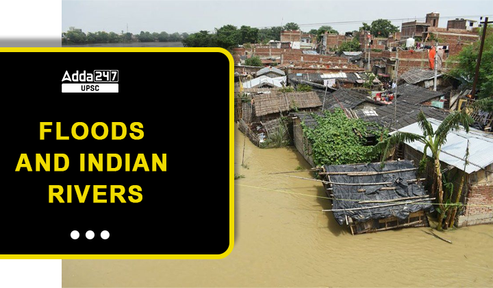
Floods in India: Excessive water accumulation on land leads to flooding. Severe rainfall or other natural disasters can occasionally result in an increased water flow in rivers. As a consequence, the water overflows from the riverbed and spreads onto the adjacent dry land, deviating from its usual course.
Urban Flooding In India
Urban flooding transpires when the amount of rainfall surpasses the capacity of drainage systems, including sanitary sewers, resulting in the inundation of land or property in developed areas. This phenomenon particularly affects densely populated regions, irrespective of whether the affected communities are situated in designated floodplains or in proximity to bodies of water.
Major Causes of Urban Flooding
The major causes for urban flooding are –
- Drainage networks in the cities lack proper planning.
- Dying water bodies
- Lack of waste disposal planning.
- Buildings and construction over the encroached water bodies.
- Climate change has resulted in heavy rainfalls.
Region Affected by Floods in India
The area that is at risk of flooding can be roughly segmented into the following four regions:
- The Brahmaputra River Region
It comprises the states of Assam, Arunachal Pradesh, Meghalaya, Mizoram, Manipur, Tripura, Nagaland, and Sikkim, in addition to the northern portions of West Bengal.
- The Region Around the Ganges
Uttarakhand, Uttar Pradesh, Jharkhand, Bihar, south and central parts of West Bengal, Punjab, parts of Haryana, Himachal Pradesh, Rajasthan, Madhya Pradesh and Delhi.
- The Region of the North-West Rivers
This region includes parts of the states of Himachal Pradesh, Haryana, and Rajasthan in addition to Jammu & Kashmir and the state of Punjab.
- The regions of Central India and the Deccan.
The states of Andhra Pradesh, Karnataka, Tamil Nadu, Kerala, Orissa, Maharashtra, and Gujarat, as well as portions of Madhya Pradesh, are included in this region.
Causes of Floods in India
Natural Causes
- Heavy Rainfall
Flooding occurs when a river’s catchment region experiences a lot of rainfall, which causes water to overflow.
In the short time from June to September, the extremely active monsoon system causes significant floods in the northern lowlands and northeastern regions.
- Snow thawing in the summer
Due to the melting of snow, Himalayan rivers like the Ganga also experience flooding in the summer.
The Brahmaputra River floods are caused by both snowmelt and rainfall.
- Geography
The Brahmaputra’s low gradient combined with the soft tertiary rocks speeds up sedimentation, which clogs river channels.
Floods in surrounding low-lying areas are brought on by the high rainfall in the hilly terrain.
- Accumulation of sediment
As a result of ongoing sedimentation, river beds become shallow. The Himalayan rivers bring in a significant amount of silt, which lowers the water-carrying capacity and causes a significant volume of water to overflow.
- Cloudburst
These are the most important factors to consider in the Himalayan region. Cloudbursts and Landslides were the primary causes of the flooding that occurred in Uttarakhand in 2013.
Anthropogenic Causes of Floods in India
- Deforestation
The flow of water is slowed down by vegetation, which aids in the process of percolation. The cutting down of trees clears the land of any barriers. Additionally, deforestation quickens the process of soil erosion and silting of river beds, both of which speed up the rate at which a river’s carrying capacity decreases.
- Interference with Drainage System
Floods are caused by the haphazard building of trains, roads, bridges, and canals, all of which are built without taking into account the natural fluvial regime.
The unplanned, short-term flood protection methods that involve a vast network of embankments have a negative impact on the natural environment.
- Population pressure
The weight of the population, particularly in metropolitan areas, leads to inefficient patterns of land use and surface sealing, both of which contribute to an increase in runoff.
- The phenomenon of urban heat islands is being increasingly recognized as a significant contributor.
Effects of Floods in India
- Loss of life
The flooding in Kerala in 2018 was responsible for the deaths of 445 people.
The Uttarakhand floods of 2013 are believed to have been the cause of death for more than 5000 people.
- Agriculture
Repeated flooding causes agricultural fields to get inundated, which results in a diminished harvest.
It is possible that the flood may make the land unproductive by altering its components.
- Infrastructure
Floods are responsible for causing extensive damage to the infrastructure, which includes roads, bridges, and trains.
The infrastructure for the generation and distribution of electricity has been affected.
- Concerns regarding health
Numerous health problems are caused as a result of a lack of sanitation, the death of livestock, and dirty water.
An outbreak of a disease like malaria, diarrhea, and other watery diseases can be expected as a result of the floods.
- Economy
The damage to infrastructure and the expense of reconstruction both have the potential to have a negative impact on the economy.
The funds, which may have been intended for use in development activity, need to be made available for efforts of rescue, relief, and rehabilitation.
- Environment
The natural environment is harmed whenever there are floods in forest areas. There has been a reduction in the amount of flora and fauna.
The flooding in Kaziranga national park resulted in the deaths of a variety of animals, including the endangered one-horned rhino.
Flood Management in India
Nearly every year, various sections of the country are hit by floods, from the very minor to the catastrophic. The Union and State governments have both placed a significant emphasis on the management of this issue. Therefore, the control of floods has always been a priority area for the government.
Authorities
The India Meteorological Department (IMD) is an agency of the Ministry of Earth Sciences of the Government of India. It is the principal agency responsible for meteorological observations, weather forecasting and seismology, offers rainfall or cyclonic event forecasts that are used by all agencies to plan for floods.
National Disaster Management Authority (NDMA): National Disaster Management Authority is established under NDMA Act 2005, The National Disaster Response Force (NDRF) works with state equivalents to carry out relief and rescue operations. The National Institute of Disaster Management (NIDM) reports to the Union Ministry of Home Affairs (MHA), and NDMA to the Prime Minister’s Office (PMO).
The Central Water Commission’s (CWC) primary responsibility is to gather hydrology data at the national level, including measurements of river discharge and water levels in dams, to warn the states of any impending or probable flooding.
National Flood Management Programme –Initiatives
Since its introduction in 1954, several flood protection strategies, both structural and non-structural, have been employed in various states based on the nature of the issue and local circumstances.
- Non-structural measures include flood forecasting, flood plain zoning, flood proofing, disaster planning, etc.
- Structural measures include storage reservoirs, flood embankments, drainage channels, anti-erosion works, channel enhancement works, and detention basins, among others.
National Flood Risk Mitigation Project (NFRMP)
It aims at ensuring that preparations are in place to mobilize the resources and ability for relief, rehabilitation, rebuilding, and recovery from tragedies besides creating consciousness among susceptible communities.
NDMA Guidelines
Structural Measures
- Building reservoirs, inspecting dams, and other structural measures can store additional water in the event of a large discharge.
- Floodwater can be diverted to wetlands, man-made and natural channels, and other areas to lessen its effects.
- Walls and embankments serve as flood protection structures by preventing the overflow of floodwater into populated areas.
- Desilting and dredging operations boost the channel’s carrying capacity and lessen spillage.
- Watershed management practices like tree planting are used in the catchment region to promote vegetation cover, decrease erosion and runoff, improve soil porosity, and deal with any abrupt surges.
Non-Structural Measures for floods in India
- Floodplain zoning, which controls land use and lessens flood damage. It entails measures such as avoiding habitation along low-lying, regularly flood-prone areas, identifying the first locations that should be evacuated in the event of a flood, and designating highlands where people should be relocated during the flood.
- Floodproofing can take the form of building flood shelters on high ground, assuring the availability of food and fodder, protecting communication lines from flooding, and ensuring the uninterrupted delivery of medical services in the event of flooding.
- Depending on the geography, frequency of floods, and population risk, each government department and agency must create its own flood control strategy.
- Community participation A centrally sponsored program by the NDMA called “Aapda Mitra” has been launched to educate 200 community volunteers in the 30 most flood-prone districts of the country to help with flood rescue and rehabilitation.
Challenges faced in Flood Management
- There have been delays in finishing the projects that are part of the flood management program.
- a deficiency in resources, most notably in terms of the support provided by the federal government to the states.
- Very few big dams in India have disaster management plans.
- There has been no progress made in the scientific evaluation of flood zones.
- A large number of states have not embraced the structure that is used for state disaster management. The response problems are made worse by the structure’s partial nature.
- The flood forecast is not very accurate at all. There is a lack of accuracy in the weather forecast.
Major floods in India
Some of the major floods in India in the past decade are
- Patna (2019)
- Kerala in 2018 and 2019
- Chennai (2015)
- Kashmir (2014)
- Uttarakhand (2013)
Way Forward
- The Sendai Framework for Disaster Risk Reduction must be implemented effectively in order to lower disaster vulnerability.
- Urban flooding requires specialized attention, and the 2016 NDMA guidelines on urban flooding must be properly implemented.
- Flood forecasting needs to be enhanced, and most crucially decentralized, so that forecasting stations can be placed in areas that are more likely to be flooded.
- Flood management institutions are required to carry out the mapping of floods on a periodic basis.
- The readiness will be improved by inspecting the structural measures both before and after the rainy season.
- Building up the capabilities of the disaster response force must be done while complying with the standards of international best practices.
Practice Question
Question: In India, floods are the most common form of natural calamity. Why does India suffer from so frequent flooding? Make some suggestions for how floods should be managed.
| Follow US |
|
| UPSC Govt Jobs UPSC Current Affairs UPSC Judiciary PCS Download Adda 247 App here to get the latest updates |


 TSPSC Group 1 Question Paper 2024, Downl...
 TSPSC Group 1 Answer key 2024 Out, Downl...
 UPSC Prelims 2024 Question Paper, Downlo...
