
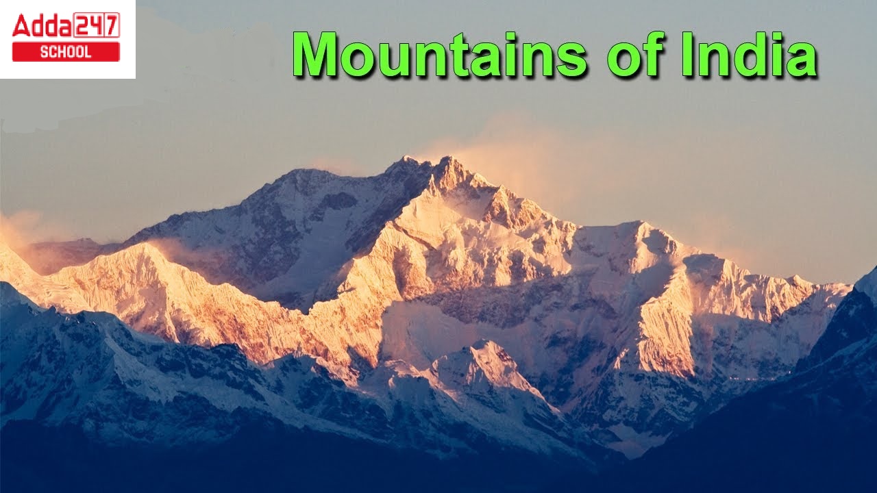
Mountains in India
Mountains in India: The Geography of India is very diverse. Here anyone can find rivers, seas, connected oceans, forests, deserts, and also different types of mountains in India. If we look at the category of mountains in India closely, it is possible for us to find a wide range of mountains in India like the Himalayan Range, Eastern Ghats Range, Satpura Range, Aravalli Range, and other mountain ranges in India with a wide range of living species out there.
Those who study the geography of India love to read about Mountains in India. If you are here to learn more about Mountains in India, then please read this article entirely.
So, let’s start-
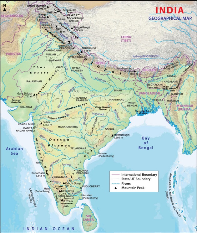
Mountain Ranges in India Map
The Geology of the mountain ranges in india map is pretty wide. India has a diverse and complex geology that has resulted in the formation of several mountain ranges. These mountain ranges include the Himalayas, the Western Ghats, the Eastern Ghats, the Aravalli Range, and the Vindhya Range.
Indian Mountain Peaks Map
Mountain Names in India
We have mentioned all the important types of mountains in India below:-
- Himalayan Mountain Range
- Western Ghats Mountain Ranges
- Eastern Ghats Mountain Ranges
- Aravali Mountain Range
- Poorvanchal Mountain Range
- Vindyas Mountain Range
- Satpura Mountain Range
- Karakoram Mountain Range
First Mountains in India- Himalayan Mountain Range
Introduction: The Himalayas is the highest mountain range in the world and is home to the highest peak, Mount Everest. It spans across six countries – India, Nepal, Bhutan, China, Pakistan, and Afghanistan.
The Himalayas are made up of a variety of rocks, including sedimentary, metamorphic, and igneous rocks. The range is also home to several glaciers and rivers that have been formed due to the constant erosion of the mountains.
| About the Himalayan Mountain Range | |
| Age | The Himalayas are estimated to be around 50 million years old. |
| Location | The Himalayan mountain range is located in the northern part of the Indian subcontinent. |
| Formation process | The Himalayas were formed due to the collision of the Indian and Eurasian tectonic plates, which started about 50 million years ago. |
| Importance | The Himalayas play a crucial role in regulating the climate of the Indian subcontinent and are also an important source of water and hydroelectric power. |
| Measurements | The Himalayas stretch over 2,400 km and have an average height of 6,000 m. |
2nd Mountains in India- Western Ghats Mountain Range
Introduction: The Western Ghats, also known as Sahyadri, is a mountain range located along the western coast of India, running parallel to the Arabian Sea. The range spans across several states including Maharashtra, Goa, Karnataka, Tamil Nadu, and Kerala, covering a total length of approximately 1,600 kilometers.
The Western Ghats are composed of ancient rocks such as granite, gneiss, and schist, and they are home to several important biodiversity hotspots, including the Western Ghats sub-cluster of the Western Ghats and Sri Lanka biodiversity hotspot.
The range is known for its rich flora and fauna, with several important wildlife reserves and national parks located within the range, including the Silent Valley National Park, the Periyar National Park, and the Bandipur National Park.
| About Western Ghats Mountain Range | |
| Age | The Western Ghats are estimated to be around 160 million years old. |
| Location | The Western Ghats are located along the western coast of India. |
| Formation process | The Western Ghats were formed due to the collision of the Indian and Eurasian tectonic plates, as well as volcanic activity. |
| Importance | The Western Ghats are known for their high levels of biodiversity and are home to many endemic species of flora and fauna. |
| Measurements | The Western Ghats cover an area of about 140,000 square km and have an average elevation of 1,200 m. |
3rd Mountains in India- Eastern Ghats Mountain Range
Introduction: The Eastern Ghats are a unarranged range of hills and mountains located in eastern India, running parallel to the Bay of Bengal. The range spans across several states including Odisha, Andhra Pradesh, Tamil Nadu, and Karnataka, covering a total length of approximately 1,750 kilometers.
The Eastern Ghats are composed of ancient rocks such as granite, gneiss, and schist, and they are rich in mineral resources such as bauxite, iron ore, and manganese. The highest peak in the range is the Mahendragiri peak, standing at an elevation of 1,501 meters.
The range is also known for its rich biodiversity, with several important wildlife reserves and national parks located within the range, including the Simlipal National Park, the Palamau Tiger Reserve, and the Kambalakonda Wildlife Sanctuary.
| About Eastern Ghats Mountain Range | |
| Age | The Eastern Ghats are estimated to be around 200 million years old. |
| Location | The Eastern Ghats are located along the eastern coast of India. |
| Formation process | The Eastern Ghats were formed due to the collision of the Indian and Eurasian tectonic plates, as well as volcanic activity. |
| Importance | The Eastern Ghats are known for their unique rock formations and are home to many endemic species of flora and fauna. |
| Measurements | The Eastern Ghats cover an area of about 75,000 square km and have an average elevation of 600 m. |
4th Mountains in India- Aravalli Mountain Range
Introduction: The Aravalli Range is a range of mountains located in western India, spanning approximately 800 kilometers from Gujarat in the south to Delhi in the north. It is one of the oldest mountain ranges in the world, estimated to be over 350 million years old. The range is composed of ancient rocks such as granite, gneiss, and schist, and it is rich in minerals such as zinc, copper, and lead.
The Aravalli Range has played an important role in Indian history and culture, with several important archaeological sites, such as the UNESCO World Heritage Site of the Hill Forts of Rajasthan, located within the range.
The highest peak in the range is Guru Shikhar, standing at an elevation of 1,722 meters, and the range is also home to several wildlife sanctuaries and national parks, including the Sariska National Park and the Ranthambore National Park.
| About Aravalli Mountain Range | |
| Age | The Aravalli Range is estimated to be around 350 million years old. |
| Location | The Aravalli Range is located in western India, running from Gujarat to Delhi. |
| Formation process | The Aravalli Range was formed due to the collision of the Indian and Eurasian tectonic plates, as well as volcanic activity. |
| Importance | The Aravalli Range is known for its rich mineral resources, including copper, zinc, and lead. |
| Measurements | The Aravalli Range covers an area of about 800 km and has an average elevation of 670 m. |
5th Mountains in India- Purvanchal Mountain Range
Introduction: The Purvanchal Range is a mountain range located in northeastern India, spanning across several states including Bihar, Jharkhand, West Bengal, Odisha, and Assam. Also known as the Eastern Ghats, the Purvanchal Range is a discontinuous range of mountains and hills that runs parallel to the Bay of Bengal, extending over 1,700 kilometers.
The range is composed of igneous and metamorphic rocks, and it is rich in mineral resources such as coal, bauxite, and iron ore. The Purvanchal Range is known for its rich biodiversity, with several important wildlife reserves and national parks located within the range, including the Sundarbans National Park, Simlipal National Park, and Buxa Tiger Reserve.
The highest peak in the range is the Deomali peak, standing at an elevation of 1,672 meters. The Purvanchal Range has played an important role in the history and culture of northeastern India, with several important archaeological sites and ancient temples located within the range.
| About Purvanchal Mountain Range | |
| Age | The Purvanchal range is estimated to be around 2 billion years old. |
| Location | The Purvanchal Mountain Range stretches from Jammu and Kashmir in the north to Manipur in the northeast. |
| Formation process | The Purvanchal Range was formed due to the collision of the Indian plate with the Eurasian plate. |
| Importance | The Purvanchal Mountain Range has significant importance as it is a major source of water for the rivers flowing through the Gangetic plain. It is also rich in biodiversity and has several wildlife sanctuaries and national parks. |
| Measurements | The highest peak in the Purvanchal Range is Namcha Barwa, which has an elevation of 7,756 meters. |
6th Mountains in India- Vindhyas Mountain Range
Introduction: The Vindhya Range is a range of hills and mountains located in central India, running approximately 1,200 kilometers from the state of Gujarat in the west to the state of Uttar Pradesh in the east. The range is composed of sedimentary rocks such as sandstone, limestone, and shale, and is known for its rich mineral resources, including coal, iron ore, and bauxite.
The Vindhya Range is an important geographical feature in India, acting as a natural boundary between the northern and southern parts of the country. The range is also home to several wildlife sanctuaries and national parks, including the Panna National Park and the Bandhavgarh National Park.
The highest peak in the range is the Amarkantak hill, standing at an elevation of 1,048 meters. The Vindhya Range has played an important role in Indian history and mythology, and it is still a significant cultural and religious site for Hindus.
| About Vindhyas Mountain Range | |
| Age | The Vindhyas Mountain Range is estimated to be around 1.7 billion years old. |
| Location | The Vindhyas Mountain Range stretches across several states in central India, including Madhya Pradesh, Uttar Pradesh, and Rajasthan. |
| Formation process | The Vindhyas Range was formed due to volcanic activity and tectonic movements. |
| Importance | The Vindhyas Mountain Range is significant as it serves as a natural boundary between northern and southern India. It is also a major source of minerals such as bauxite, iron ore, and copper. |
| Measurements | The highest peak in the Vindhyas Mountain Range is Mahadeo Peak, which has an elevation of 1,501 meters. |
7th Mountains in India- Satpura Mountain Range
Introduction: The Satpura Mountain Range is a range of hills located in central India, spanning across the states of Maharashtra, Madhya Pradesh, and Gujarat. The name “Satpura” is derived from the Sanskrit words “Sat” (meaning seven) and “Pura” (meaning fold), referring to the seven hills that make up the range.
The Satpura Range is known for its rich biodiversity, including several endangered species of plants and animals, and it is also home to several tribal communities. The range is composed of sandstone, shale, and limestone, and it has several rivers and waterfalls that add to its natural beauty.
The highest peak in the range is Dhupgarh, which stands at an elevation of 1,350 meters. The Satpura Range is a popular destination for trekking, wildlife safaris, and nature tourism.
| About Satpura Mountain Range | |
| Age | The Satpura Mountain Range is estimated to be around 1.5 billion years old. |
| Location | The Satpura Mountain Range stretches across several Indian states including Madhya Pradesh, Maharashtra, and Gujarat. |
| Formation process | The Satpura Range was formed due to geological upliftment, faulting, and folding. |
| Importance | The Satpura Mountain Range is significant as it is a major source of minerals and ores such as coal, iron ore, and bauxite. It is also home to several national parks and wildlife sanctuaries, including the Satpura Tiger Reserve. |
| Measurements | The highest peak in the Satpura Mountain Range is Dhupgarh, which has an elevation of 1,350 meters. |
8th Mountains in India- Karakoram Mountain Range
Introduction: The Karakoram Mountain Range is a high-altitude mountain range located in the northernmost part of the Indian subcontinent, stretching across the borders of Pakistan, India, and China. It is part of the greater Himalayan mountain system and is home to some of the world’s highest peaks, including K2, the second-highest peak in the world.
The range was formed as a result of the collision between the Indian and Eurasian tectonic plates, resulting in the formation of high peaks, deep valleys, and extensive glaciers.
The Karakoram Range is known for its rugged terrain, extreme weather conditions, and rich cultural history, with several indigenous communities living in the region. The range is popular among mountaineers, trekkers, and adventure enthusiasts from around the world.
| About Karakoram Mountain Range | |
| Age | The Karakoram Mountain Range is estimated to be around 100 million years old. |
| Location | The Karakoram Mountain Range stretches across the borders of Pakistan, India, and China. |
| Formation process | The Karakoram Range was formed due to the collision of the Indian and Eurasian tectonic plates. |
| Importance | The Karakoram Mountain Range is significant as it is home to some of the highest peaks in the world, including K2, which is the second-highest mountain in the world. It is also a source of several large rivers, including the Indus and the Shyok. |
| Measurements | The highest peak in the Karakoram Mountain Range is K2, which has an elevation of 8,611 meters. |


 Maharashtra NEET Counselling 2026: Regis...
 UP NEET Counselling 2026: Registration, ...
 NEET OMR Sheet 2026 Out, Download Respon...