
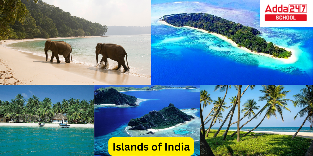
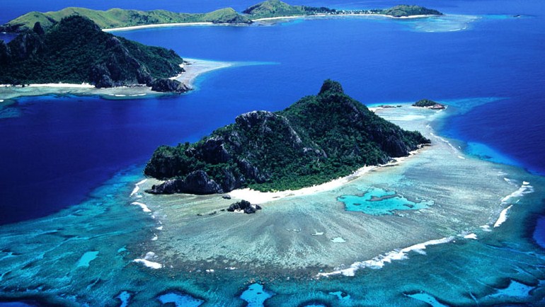
Islands of India
Islands of India are a very important part of Indian Tourism. India is home to two significant island groups: the Lakshadweep islands in the Arabian Sea and the Andaman and Nicobar Islands in the Gulf of Bengal. Other than the two groups mentioned above, there are islands in the Indo-Gangetic Delta that are more like delta remnants than actual islands, as well as islands between India and Sri Lanka that are the remains of Adams Bridge or Rama Setu that were formed by submergence.
What is an Island?
A section of subcontinental land that is entirely encircled by water is known as an island or isle. Islets, skerries, cays, or keys are terms used to describe very small islands, such as emergent land features on atolls. An eyot or ait is the name for an island in a river or lake, and a holm is the name for a tiny island off the shore. Chars are sedimentary islands found in the Ganges Delta. An archipelago is a collection of physically or geologically connected islands, such as the Philippines. Oceanic and continental islands are the two main types of islands in the sea. Moreover, man-made islands exist.
Physiographic Divisions of India

Islands in India- All Majar Indian Islands Name in India
India has a number of islands scattered across its coastline and inland water bodies. Here are some of the notable islands in India:
- Andaman and Nicobar Islands: This is a group of 572 islands in the Bay of Bengal, and is one of the Union Territories of India. Some of the major islands in this group include Port Blair, Havelock Island, Neil Island, and Baratang Island.
- Lakshadweep Islands: Located in the Arabian Sea, Lakshadweep is another Union Territory of India. Some of the main islands in this group include Kavaratti, Agatti, Minicoy, and Bangaram.
- Majuli Island: Located in the Brahmaputra River in Assam, Majuli is one of the largest river islands in the world.
- Rameswaram Island: It is situated in the Gulf of Mannar, in Tamil Nadu. It is known for its religious significance and is connected to the mainland by the Pamban Bridge.
- Elephanta Island: Located in the Mumbai Harbor, it is famous for the Elephanta Caves, a UNESCO World Heritage Site, known for its rock-cut temples dedicated to Lord Shiva.
- Diwar Island: Also known as Divar Island, it is located in Goa, in the Mandovi River. It is known for its scenic beauty and old Portuguese-style houses.
- Saint Mary’s Island: Situated off the coast of Karnataka, these islands are known for their unique hexagonal-shaped basaltic rock formations.
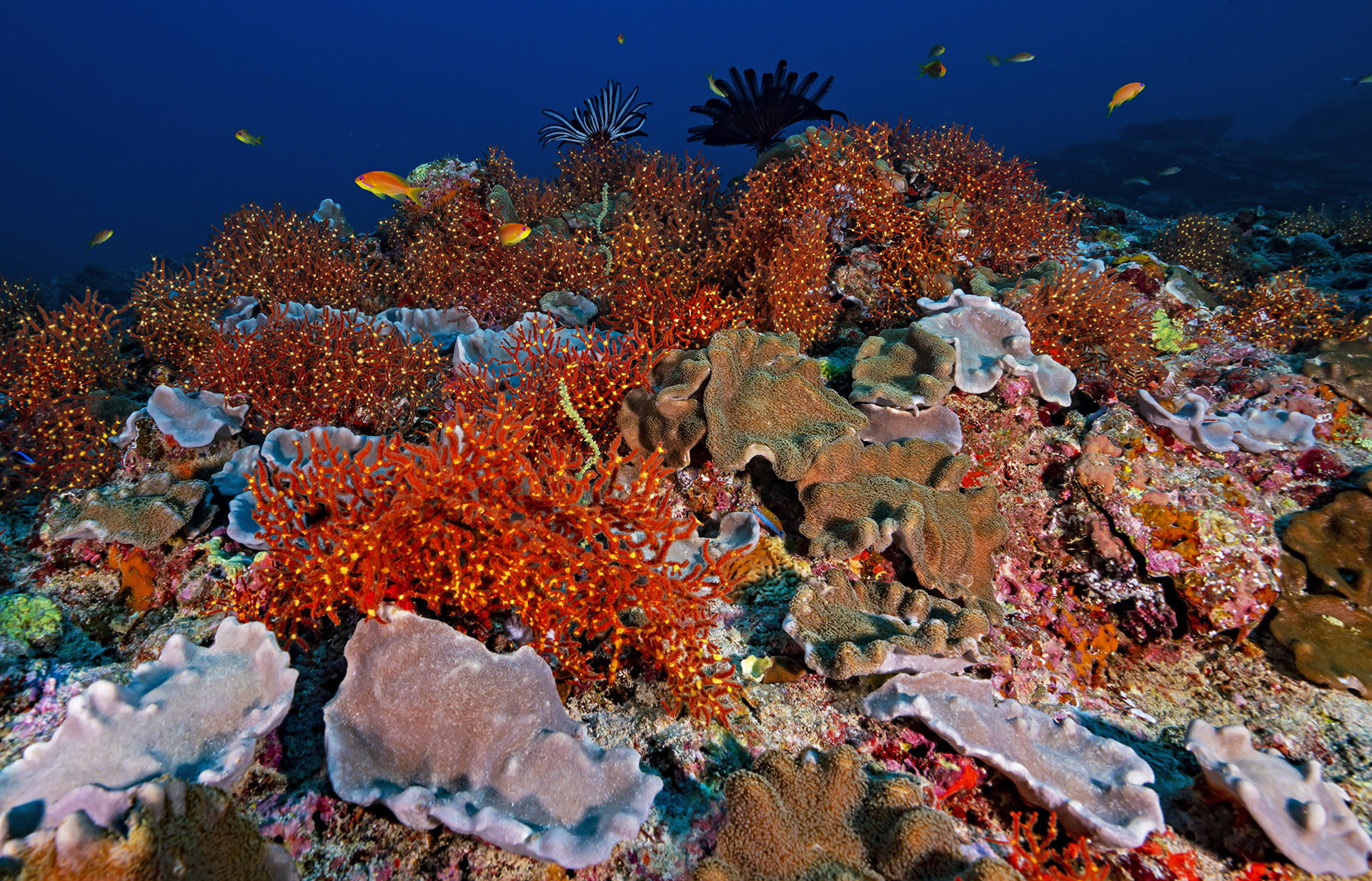
- Netrani Island: Also known as Pigeon Island, it is a small island off the coast of Karnataka, known for its coral reefs and rich marine life.
- Bet Dwarka: Located near the holy city of Dwarka in Gujarat, this island is believed to be the original abode of Lord Krishna.
- Sunderbans: While not traditional islands, the Sundarbans is a vast delta region in West Bengal and Bangladesh, known for its unique ecosystem and network of waterways, islands, and mangrove forests.
These are a few of the islands in India, and there are many more smaller and lesser-known ones scattered along its vast coastline and within its rivers and lakes. Each of these islands has its own unique natural beauty, cultural significance, and attractions.
Islands of India: Andaman and Nicobar
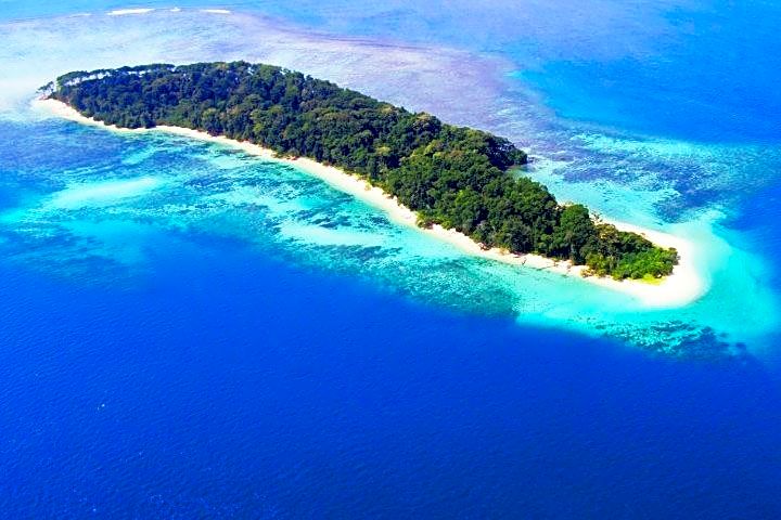
In the confluence of the Bay of Bengal and the Andaman Sea are the Andaman and Nicobar Islands, a union territory of India made up of 572 islands, 37 of which are inhabited. The Andaman Sea divides the region from Thailand and Myanmar, and it is located roughly 150 km north of Aceh in Indonesia.
It consists of two island groups, the Andaman Islands (partially) and the Nicobar Islands, which are situated north and south of the 10°N parallel and are connected by the 150 km-wide Ten Degree Channel. To the east and west, respectively, are the Andaman Sea and the Gulf of Bengal. The Arakan Mountains are believed to have a submerged extension in the form of the island chains.
The town of Port Blair serves as the territory’s capital. The islands’ total land area is roughly 8,249 km2. Three districts make up the territory: the Nicobar District, whose capital is Car Nicobar; the South Andaman District, whose capital is Port Blair; and the North and Middle Andaman District, whose capital is Mayabunder. The Andaman and Nicobar Command, the only geographical tri-service command of the Indian Armed Forces, is located on the islands.
The Sentinelese people, an uncontacted tribe, reside on the Andaman Islands. The Sentinelese are said to be the only people alive today who have not advanced beyond a Paleolithic level of technology, yet this is debatable because metalworking evidence was discovered on their island.
Islands of India: Flora of Andaman and Nicobar
- The tropical rainforest canopy in the Andaman and Nicobar Islands is made up of a hybrid flora that includes strains from India, Myanmar, Malaysia, and indigenous floral species.
- Over 2,200 plant species have been identified thus far, of which 200 are indigenous and 1,300 are absent from mainland India.
- In the South Andaman jungles, ferns and orchids dominate the epiphytic plant life. Most of the forests in the Middle Andamans are moist deciduous forests.
- The North Andamans are known for its moist evergreen vegetation and profusion of woody climbers.
- Evergreen woods are completely absent from the North Nicobar Islands, but they predominate in the middle and southern islands of the Nicobar group.
- Only on the Nicobar Islands are grasslands found, as compared to the Andaman Islands, where deciduous woods are more prevalent.
- 86.2% of the total land area is said to be covered by forests at this time.
Islands of India: Fauna of Andaman and Nicobar
Despite being cut off from nearby landmasses, this tropical rain forest is surprisingly abundant in different kinds of animals.
- The Andaman and Nicobar Islands are home to about 50 different kinds of forest animals.
- Some, like the Andaman wild boar, are endemic. With 26 species, rodents are the largest group, followed by 14 species of bat.
- Two indigenous species of wild pig, Sus scrofa andamanensis from Andaman and Sus scrofa nicobaricus from Nicobar, are among the bigger mammals and are protected by the Wildlife Protection Act of 1972. (Sch I).
- There are also a lot of saltwater crocodiles.
- The dugong, also referred to as the sea cow and found in Little Andaman, is the state animal of Andaman.
- Due to insufficient habitat, an attempt to introduce the leopard occurred about 1962 but failed.
- These were poor decisions because introducing exotic species can devastate the island’s ecology and biodiversity.
- Elephants can also be found in the islands’ mountainous or forested regions; in 1883, they were transported from the mainland to aid in the removal of timber.
The Andaman and Nicobar Islands are home to about 270 different bird species, 14 of which are indigenous. The edible-nest swiftlet, whose nests are treasured in China for bird’s nest soup, breeds in the numerous caves on the islands. Many migratory birds, including Horsfield’s bronze cuckoo, Zappey’s flycatcher, and Javan pond heron, stop over on the islands.
- Almost 225 different species of butterflies and moths call the region home.
- These Islands are home to ten distinct species.
- One of the Andaman & Nicobar Islands’ most diverse butterfly and moth habitats is Mount Harriet National Park.
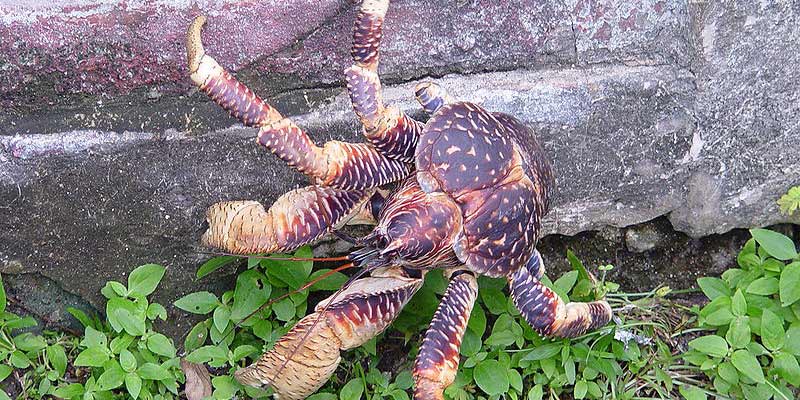
- The islands are renowned for their high-quality shellfish, particularly those belonging to the genera Turbo, Trochus, Murex, and Nautilus.
- The first known commercial exploitation started in 1929.
- A variety of beautiful shell objects are produced by numerous cottage companies.
- The edible shellfish industry is supported by giant clams, green mussels, and oysters.
- Kilns are used to burn scallop, clam, and cockle shells to create edible lime.
In the Andaman and Nicobar Islands, there are 96 wildlife sanctuaries, nine national parks, and one biosphere reserve.

There are two groups of Islands in the Andaman and Nicobar group of Islands:
Islands of India- Andaman Islands
The Andaman Islands are an archipelago located 130 km (81 mi) southwest of the shores of Myanmar’s Ayeyarwady Region in the northeastern Indian Ocean. The Andaman Islands act as a maritime border between the Andaman Sea and the Gulf of Bengal to the east, along with the Nicobar Islands to their south. The majority of the islands are a part of Myanmar’s Yangon Region, while the Coco Islands and Preparis Island are a part of India’s Union Territory of the Andaman and Nicobar Islands.
The Andamanese are a diverse collection of indigenous people that live in the Andaman Islands, including the Jarawa and Sentinelese tribes. While some of the islands can be visited with a permit, North Sentinel Island is one among those where entry is prohibited by law. The Sentinelese have minimal interaction with other people and are typically hostile to outsiders. Their right to privacy is safeguarded by the government.
Islands of India: Nicobar Islands
In the eastern Indian Ocean, there is an archipelago of islands known as the Nicobar Islands. They are situated in Southeast Asia 150 km (93 mi) northwest of Aceh in Sumatra, and the Andaman Sea divides them from Thailand to the east. They are a part of India as the Nicobar district within the union territory of the Andaman and Nicobar Islands, which is 1,300 kilometres (810 mi) southeast of the Indian subcontinent. The Great Nicobar Island has been designated as one of the Global Network of Biosphere Reserves by UNESCO.
Islands of India: Lakshadweep Islands
- India’s Lakshadweep is a union territory. It is a 36-island archipelago in the Arabian Sea, 200 to 440 kilometres off the Malabar Coast.
- The Laccadive Islands are only a small portion of the archipelago, which consists of no more than 100 islands, although the name Lakshadweep means “one lakh islands” in both Malayalam and Sanskrit.
- The primary and most extensively spoken native language in the region is Malayalam.
- The islands have a total surface area of only 32 km2, making them the smallest union territory of India.
- The territorial seas are 20,000 km2, the lagoon is 4,200 km2, and the exclusive economic zone is 400,000 km2.
- With 10 subdivisions, the area forms a single Indian district.
- The Union Territory’s capital is Kavaratti, and the Kerala High Court has jurisdiction over the area.
- The Lakshadweep-Maldives-Chagos group of islands, which are the summits of a huge undersea mountain range known as the Chagos-Lakshadweep Ridge, includes the islands as their most northern member.
- Originally, there were 36 islands in the Lakshadweep; however, 35 islands are still there as a result of marine erosion on the Parali 1 island.

- The Buddhist Jataka legends from the sixth century BCE made reference of the islands as well.
- When Muslims arrived in the area in the seventh century, Islam was founded there.
- The Chera dynasty, the Chola dynasty, and lastly the Kingdom of Kannur dominated the area during the Middle Ages.
- Around 1498, the Catholic Portuguese people came, but they were driven out by 1545.
- Following Tipu Sultan, the Muslim house of Arakkal, who served as the Kolathiri Rajas of Kannur’s vassals, dominated the province.
- The majority of the area was given to the British after his death in 1799, and the Union Territory was established in 1956 as a result of their departure.
- Ten of the 36 total islands are populated. There were 64,473 people living in the Union Territory as of the 2011 Indian Census.
- The vast majority of the native population is Muslim and follows the Shafi school of Islam, which is a branch of the Sunni sect.
- The Malayali people of Kerala, the closest Indian state, are ethnically related to the islanders.
- Dhivehi is the most common language in Minicoy island, where the majority of the people speaks Malayalam.
- With the exception of the southernmost island of Minicoy, where the Mahl dialect is spoken, the inhabited islands of the archipelago, particularly the Amindivi and Laccadive Islands, speak the Jeseri dialect.
Jeseri was written in Malayalam using the Ponnani script till the British Raj. The culture is almost identical to that of the Mappilas in Kerala, the closest mainland state. On Agatti Island, there is an airport that serves the islands. The primary export product is tuna, and the people’s primary sources of income are fishing and coconut farming.
Islands of India: Flora and Fauna of Lakshadweep Islands
The Maldives-Lakshadweep-Chagos Archipelago Tropical Moist Forests Ecoregion is made up of the Lakshadweep Archipelago, the Maldives, and the Chagos. It has over 600 different species of marine fish, 78 different kinds of coral, 82 different kinds of seaweed, 52 different kinds of crabs, 2 kinds of lobsters, 48 different kinds of gastropods, 12 different kinds of bivalves, and 101 different kinds of birds. One of India’s four coral reef regions, it.

The area does not have a particularly diverse plant life, and practically all of the plants may be found on the Indian subcontinent. Moreover, there are no forests in the area. There are known to be close to 400 species of flowering plants.
There are other two Islands of India, Daman and Diu Islands and Puducherry Islands:
Islands of India: Daman and Diu Islands
Daman and Diu in northwest India used to be a union territory. At only 112 km2, it was the smallest administrative division of India on the mainland (43 sq mi). The Gulf of Khambat separated the area’s two districts, Damaon and Dio island. The territory was bounded by the Gujarat state and the Arabian Sea. From the 1500s, Goa has been a Portuguese province; in 1961, India seized the territory.
Daman and Diu were ruled as a part of the Goa Union Territory from 1961 to 1987, but they were granted distinct union territory status following the Goa Opinion Poll. Legislation to combine the union territories of Daman and Diu and its neighbouring union territory, Dadra and Nagar Haveli, was passed in 2019. The new union territory of Dadra and Nagar Haveli and Daman and Diu would go into force on January 26, 2020.
Islands of India: Puducherry Islands
The Indian union territory of Puducherry, often spelled Pondicherry or Pondichéry, is made up of four interconnected minor districts. It was created from four former French Indian territories: Pondichery, Karikal (Karaikal), Mahé, and Yanaon (now Yanam), excluding Chandannagar (Chandernagore), and it was given the name Puducherry after the largest district, which was also the old French Indian capital. Previously known as Pondicherry, the region’s official name was changed to Puducherry on September 20, 2006.
There are four interrelated small districts that make up the Indian union territory of Puducherry, which is often written Pondicherry or Pondichéry. With the exception of Chandannagar (Chandernagore), it was formed from four former French Indian territories: Pondichery, Karikal (Karaikal), Mahé, and Yanaon (now Yanam). It was given the name Puducherry after the largest district, which was also the former French Indian capital. On September 20, 2006, the area’s official name, Puducherry, which had previously been Pondicherry, was changed.
How Many Islands are There in India?
India has numerous islands, but the exact number can vary depending on the criteria used to define an island. There are over 1,200 islands in India, and some of the major ones include:
- Andaman Islands
- Nicobar Islands
- Lakshadweep Islands
- Elephanta Island
- Rameswaram Island
- Diu Island
- Daman Island
- St. Mary’s Island
- Majuli Island
- Neil Island
Western Ghats Biodiversity, States, Mountain and Highest Peak
List of Islands of India
list of some of the major islands of India:
- Andaman Islands
- Nicobar Islands
- Lakshadweep Islands
- Majuli (Assam)
- Havelock Island
- Neil Island
- Rameswaram Island
- Elephanta Island
- Diu Island
- St. Mary’s Island (Karnataka)
- Barren Island
- Daman and Diu Islands
- Little Andaman Island
- Great Nicobar Island
- Ross Island
- North Sentinel Island
- Viper Island
- Sagar Island (West Bengal)
- Bet Dwarka (Gujarat)
- Kalapeni (Suheli Par)


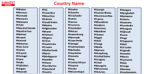 All Country Name List in Alphabetical Or...
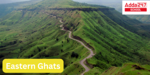 Eastern Ghats in India: Check Map, State...
 Sustainable Development Project Class 10...