
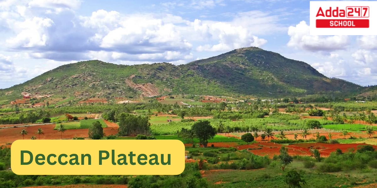
Deccan Plateau
The vast Deccan Plateau, which can be roughly defined as the peninsular area between these mountain ranges that is south of the Narmada river, is situated between the Western Ghats and the Eastern Ghats in southern India. It is bordered to the north by the Satpura and Vindhya Ranges.
It gave rise to some of the most significant dynasties in Indian history, such as the Pallavas, Satavahana, Vakataka, Chalukya, and Rashtrakuta dynasties, as well as the Western Chalukya Empire, the Kadambas, the Yadava dynasty, the Kakatiya Empire, the Musunuri Nayakas regime, the Vijayanagara and the Maratha empires.
Different definitions of Deccan have been offered by historians. These definitions range from a limited one by R. G. Bhandarkar in 1920 that limits the term to the Marathi-speaking region between the Godavari and Krishna rivers to a broad one by K. M. Panikkar in 1969 that include the entire Indian peninsula south of the Vindhyas. According to Firishta (c. 16th c.), the Deccan is the region that is home to native Kannada, Marathi, and Telugu speakers. This linguistic term is chosen by Richard M. Eaton in 2005 to describe the geopolitical history of the area.
According to Stewart N. Gordon in 1998, the northern border of Deccan has changed historically, ranging from the Tapti River in the north to the Godavari River in the south.
Deccan Plateau in India Rivers
The elevation of Deccan Plateau ranges from 100 to 1,000 metres (330 and 3,280 ft), with an average of about 600 metres. It is a rocky environment highlighted by stones (2,000 ft). Deccan Plateau slopes primarily eastward. As a result, its three main rivers—Godavari, Krishna, and Kaveri (Cauvery)—flow from the Western Ghats to the Bay of Bengal in an easterly direction. The plateau is arid in certain areas and drier than southern India’s coastal region.
Godavari River Length, Origin, Map and Tributaries
Deccan Plateau in India Maps
A tall triangular tableland is located in the middle of the Deccan, the entire southern peninsula of India south of the Narmada River. The word “Deccan” is derived from the Sanskrit word “daksina.” The Ghats, escarpments that converge at the plateau’s southernmost point, encircle it on the east and west. The Sanskrit words daksina and subsequently Prakrit word dakkhin, which mean the “south,” have etymological roots in the Kannada term dakkhaa, whichis from the word “Deccan” finds its source.


Deccan Plateau in India
Bangalore, the city of Karnataka, Hyderabad, the capital of Telangana, Pune, the cultural centre of Maharashtra, Nagpur, the second capital of Maharashtra, and Nashik, the wine capital of Maharashtra, are among the major cities in the Deccan. Other significant cities include Hubli, Mysore, Gulbarga, and Bellary in Karnataka; Aurangabad, Solapur, Amravati, Kolhapur, Akola, Latur, Sangli, Jalgaon, Nanded, Dhule, Chandrapur, and Satara in Maharashtra; Hosur, Krishnagiri, Tiruvannamalai, Vellore, and Ambur in Tamil Nadu; Amaravati, Visakhapatnam, Kurnool, Vijayawada, Guntur, Anantapur, Rajahmundry, Eluru, in Andhra Pradesh; and Warangal, Karimnagar, Ramagundam, Nizamabad, Suryapet, Siddipet, Nalgonda, Mahbubnagar in present-day Telangana and Jagdalpur, Bhawanipatna in the Northeastern part of the Deccan Plateau.
What is the Capital of Arunachal Pradesh?
Deccan Peninsula Geography and Geology
The Deccan plateau is a topographically diverse territory south of the Gangetic plains, which are the area between the Arabian Sea and the Bay of Bengal. It also includes a sizeable area to the north of the Satpura Range, which is sometimes referred to as the boundary between northern India and the Deccan. The Vindhya Range is the northernmost point of the plateau, and the Ghats form its eastern and western boundaries. The Godavari, Krishna, and Kaveri are the three major rivers that flow from the Western Ghats to the Bay of Bengal in the Deccan, which has an average elevation of 600 metres (2,000 feet) and slopes primarily eastward. The Tamil Nadu city of Tiruvannamalai is frequently referred to be the Deccan plateau’s Southern entrance.
The plateau of the Deccan is incredibly rich in minerals and priceless stones. Many lowland kings, especially those of the Mauryan (4th–2nd century BCE) and Gupta (4th–6th century CE) dynasties, fought over the plateau’s mineral wealth. Coal, iron ore, asbestos, chromite, mica, and kyanite are some of the principal minerals found here. Large uranium reserves have been found in Karnataka’s Tummalapalle belt and Bhima basin in Gogi since March 2011. One of the top 20 uranium reserve discoveries in the world is expected to be made in the Tummalapalle belt.
Eastern Ghats Biodiversity, Geology, States, Map and Rivers
Western Ghats Biodiversity, States, Mountain and Highest Peak
 CLAT 2027 Preparation: Complete Study Pl...
 Best CLAT Online Course 2027: Why Adda24...
 Best Strategy to Attempt the CUET Exam f...