
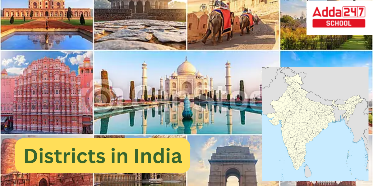
Our country India is vast both in terms of land and population. Due to its vastness, it has been divided into several levels for better administration and policy implementation. The whole land mass of India is divided into different states and union territories. The states are further divided into zones and districts. Districts are further divided into cities, blocks, and panchayats. The district is one such division that is basically analogous to the administrative unit of a country. In this article, we will cover different aspects of the districts of India. Let us know How Many Districts in India.
How Many District in India 2024
An administrative division of an Indian state or territory is called a district (zila). Districts can be further divided into tehsils or talukas in some circumstances, and into sub-divisions in others. There are 766 districts in India total as of August 2022, an increase from the 640 districts counted in the India Census of 2011 and the 593 districts counted in the India Census of 2001. These districts serve as a primary point for policy implementation.
How Many Districts in India
In India as of January 2024, there are a total of 766 districts. However, please note that administrative divisions can change over time, and it’s possible that there have been changes or additions to the number of districts in India since then. I recommend checking the latest information from a reliable source or the official government website for the most up-to-date information on the number of districts in India.
Administration of Districts in India
District representatives include:
- An Indian Administrative Service officer who oversees administration and tax collection is known as a District Magistrate, Deputy Commissioner, or District Collector.
- A member of the Indian Police Service who is in charge of upholding law and order may be referred to as a superintendent of police, senior superintendent of police, or deputy commissioner of police.
- Deputy Conservator of Forests, an Indian Forest Service employee in charge of overseeing the district’s forests, environment, and wildlife
Officers from the relevant branch of the state government assist each of these officials. The majority of districts have an unique headquarters, however there are several districts without one, such as Mumbai City in Maharashtra, Kolkata in West Bengal, Hyderabad in Telangana, and Chennai in Tamil Nadu, despite having district collectors.
Smallest and Largest District In India
Smallest District in India
One of the four districts in the Indian union territory of Puducherry is Mahe. It encompasses the entire Mahé region. Mahé is India’s tiniest district in terms of area. North Malabar in Kerala State encircles the entire Mahé district.
Largest District in India
Gujarat’s Kachchh district is the largest district in India. Pakistan borders it to the north and northwest, while Rajasthan State borders it to the northeast. The district’s overall area is 45,674 square kilometres, or 23.27% of Gujarat’s entire geographic area.
Total District in India- States and Union Territories Wise
| State or Union Territory | Number of Districts | Population of State |
| West Bengal | 23 | 91,276,115 |
| Uttarakhand | 13 | 10,086,292 |
| Uttar Pradesh | 75 | 199,812,341 |
| Tripura | 8 | 3,673,917 |
| Telangana | 33 | 35,003,674 |
| Tamil Nadu | 38 | 72,147,030 |
| Sikkim | 6 | 610,577 |
| Rajasthan | 33 | 68,548,437 |
| Punjab | 23 | 27,743,338 |
| Puducherry | 4 | 1,247,953 |
| Odisha | 30 | 41,974,218 |
| Nagaland | 16 | 1,978,502 |
| Mizoram | 11 | 1,097,206 |
| Meghalaya | 12 | 2,966,889 |
| Manipur | 16 | 2,570,390 |
| Maharashtra | 36 | 112,374,333 |
| Madhya Pradesh | 52 | 72,626,809 |
| Lakshadweep | 1 | 64,473 |
| Ladakh | 2 | 290,492 |
| Kerala | 14 | 33,406,061 |
| Karnataka | 31 | 61,095,297 |
| Jharkhand | 24 | 32,988,134 |
| Jammu and Kashmir | 20 | 12,258,093 |
| Himachal Pradesh | 12 | 6,864,602 |
| Haryana | 22 | 25,351,462 |
| Gujarat | 33 | 60,439,692 |
| Goa | 2 | 1,458,545 |
| Delhi | 11 | 16,787,941 |
| Dadra and Nagar Haveli and Daman and Diu | 3 | 586,956 |
| Chhattisgarh | 33 | 25,545,198 |
| Chandigarh | 1 | 1,055,450 |
| Bihar | 38 | 104,099,452 |
| Assam | 35 | 31,205,576 |
| Arunachal Pradesh | 26 | 1,383,727 |
| Andhra Pradesh | 26 | 49,577,103 |
| Andaman and Nicobar Islands | 3 | 380,581 |
| Total | 766 | 1,210,576,856 |
|---|
Total Number of Districts in India
Total number of districts in India is 766 Districts. Check Name of all districts in India here in this article.
Check out all district lists in India state wise.
Total Districts in Andhra Pradesh, India
India’s south-eastern coastline region is home to the state of Andhra Pradesh. It is the tenth-most populous state, with 49,386,799 residents, and the seventh-largest state in terms of size, having an area of 162,975 square kilometres. On October 1, 1953, Andhra State became the first state in India to be established on the basis of a language.
Out of the districts in India following are the districts in Andhra Pradesh:
- Alluri Sitharama Raju
- Anakapalli
- Ananthapuramu
- Annamayya
- Bapatla
- Chittoor
- Dr. B.R. Ambedkar Konaseema
- East Godavari
- Eluru
- Guntur
- Kakinada
- Krishna
- Kurnool
- Nandyal
- NTR
- Palnadu
- Parvathipuram Manyam
- Prakasam
- Srikakulam
- Sri Potti Sriramulu Nellore
- Sri Sathya Sai
- Tirupati
- Visakhapatnam
- Vizianagaram
- West Godavari
- YSR
Total Districts in Arunachal Pradesh, India
Northeastern India contains the state of Arunachal Pradesh. It was created from the former North-East Frontier Agency (NEFA) region, and on February 20, 1987, it was admitted as a state. The state capital of Arunachal Pradesh is Itanagar. By area, Arunachal Pradesh is the largest of Northeast India’s Seven Sister States.
Out of the districts in India following are the districts in Arunachal Pradesh:
- Anjaw
- Changlang
- East Kameng
- East Siang
- Itanagar capital complex
- Kamle
- Kra Daadi
- Kurung Kumey
- Lepa Rada
- Lohit
- Longding
- Lower Dibang Valley
- Lower Siang
- Lower Subansiri
- Namsai
- Pakke-Kessang
- Papum Pare
- Shi Yomi
- Siang
- Tawang
- Tirap
- Upper Dibang Valley
- Upper Siang
- Upper Subansiri
- West Kameng
- West Siang
Total Districts in Assam
Northeastern India’s Assam state is located along the valleys of the Brahmaputra and Barak Rivers, south of the eastern Himalayas. The size of Assam is 78,438 square kilometres. The state is bordered to the north by Bhutan and Arunachal Pradesh, to the east by Nagaland and Manipur, to the south by Meghalaya, Tripura, Mizoram, and Bangladesh, and to the west by West Bengal via the 22-kilometer-wide Siliguri Corridor, which connects the state to the rest of India.
Out of the districts in India following are the districts in Assam:
- Bajali
- Baksa
- Barpeta
- Biswanath
- Bongaigaon
- Cachar
- Charaideo
- Chirang
- Darrang
- Dhemaji
- Dhubri
- Dibrugarh
- Dima Hasao
- Goalpara
- Golaghat
- Hailakandi
- Hojai
- Jorhat
- Kamrup
- Kamrup Metropolitan
- Karbi Anglong
- Karimganj
- Kokrajhar
- Lakhimpur
- Majuli
- Morigaon
- Nagaon
- Nalbari
- Sivasagar
- South Salmara Mankachar
- Sonitpur
- Tamulpur
- Tinsukia
- Udalguri
- West Karbi Anglong
Total Districts in Bihar
Eastern India contains the state of Bihar. It ranks second in terms of population, 12th in terms of area (94,163 sq km), and 14th in terms of GDP in 2021. Bihar shares borders with Jharkhand to the south, Uttar Pradesh to the west, Nepal to the north, and the northern portion of West Bengal to the east. The Ganges River, which runs from west to east, splits the Bihar plain.
Out of the districts in India following are the districts in Bihar:
- Araria
- Arwal
- Aurangabad
- Banka
- Begusarai
- Bhagalpur
- Bhojpur
- Buxar
- Darbhanga
- East Champaran
- Gaya
- Gopalganj
- Jamui
- Jehanabad
- Kaimur
- Katihar
- Khagaria
- Kishanganj
- Lakhisarai
- Madhepura
- Madhubani
- Munger
- Muzaffarpur
- Nalanda
- Nawada
- Patna
- Purnia
- Rohtas
- Saharsa
- Samastipur
- Saran
- Sheikhpura
- Sheohar
- Sitamarhi
- Siwan
- Supaul
- Vaishali
- West Champaran
Total Districts in Chhattisgarh
Central India’s landlocked state of Chhattisgarh. With around 30 million people, it is the seventeenth most populous state by population and the ninth largest state in terms of land area. Prior to being granted statehood on November 1, 2000, it was a part of Madhya Pradesh, with Raipur serving as the capital.
Out of the districts in India following are the districts in Chhattisgarh:
- Balod
- Baloda Bazar
- Balrampur-Ramanujganj
- Bastar
- Bemetara
- Bijapur
- Bilaspur
- Dantewada
- Dhamtari
- Durg
- Gariaband
- Gaurela-Pendra-Marwahi
- Janjgir-Champa
- Jashpur
- Kabirdham
- Kanker
- Khairagarh-Chhuikhadan-Gandai
- Kondagaon
- Korba
- Korea
- Mahasamund
- Manendragarh-Chirmiri-Bharatpur
- Mohla-Manpur-Ambagarh Chowki
- Mungeli
- Narayanpur
- Raigarh
- Raipur
- Rajnandgaon
- Sarangarh-Bilaigarh
- Shakti
- Sukma
- Surajpur
- Surguja
Total Districts in Goa
The Western Ghats physically divide the Deccan highlands from the state of Goa, which is located on the southwest coast of India inside the Konkan area. With the Arabian Sea forming its western coast, it is situated between the Indian states of Maharashtra to the north and Karnataka to the east and south. By both size and population, it is the fourth-smallest state in India.
Out of the districts in India following are the districts in Goa:
- North Goa
- South Goa
Total Districts in Gujarat
Gujarat is a state located on India’s western coast. Its 1,600 km of coastline, the majority of which is on the Kathiawar peninsula, is the longest in the nation. Gujarat is the ninth-most populated state in India, with a population of 60.4 million. It is also the fifth-largest state by area, comprising over 196,024 km2. Gujaratis are native residents of the state, and Gujarati is the official language of Gujarat.
Out of the districts in India following are the districts in Gujarat:
- Ahmedabad
- Amreli
- Anand
- Aravalli
- Banaskantha
- Bharuch
- Bhavnagar
- Botad
- Chhota Udaipur
- Dahod
- Dang
- Devbhumi Dwarka
- Gandhinagar
- Gir Somnath
- Jamnagar
- Junagadh
- Kheda
- Kutch
- Mahisagar
- Mehsana
- Morbi
- Narmada
- Navsari
- Panchmahal
- Patan
- Porbandar
- Rajkot
- Sabarkantha
- Surat
- Surendranagar
- Tapi
- Vadodara
- Valsad
Total Districts in Haryana
The northern region of the country is home to the Indian state of Haryana. On 1 November 1966, it was separated from the erstwhile state of East Punjab on the grounds of language. With less than 1.4% (44,212 km2) of India’s total land area, it is the 21st largest country by area. There are 154 cities and towns, 6,222 village panchayats, 93 revenue tehsils, 72 sub-divisions, 22 districts, 6 administrative divisions, 7,356 villages, and 93 revenue tehsils in Haryana.
Out of the districts in India following are the districts in Haryana:
- Ambala
- Bhiwani
- Charkhi Dadri
- Faridabad
- Fatehabad
- Gurugram
- Hisar
- Jhajjar
- Jind
- Kaithal
- Karnal
- Kurukshetra
- Mahendragarh
- Nuh
- Palwal
- Panchkula
- Panipat
- Rewari
- Rohtak
- Sirsa
- Sonipat
- Yamunanagar
Total Districts in Jharkhand
Eastern India contains the state of Jharkhand. The states of West Bengal to the east, Chhattisgarh to the west, Uttar Pradesh to the northwest, Bihar to the north, and Odisha to the south all share a boundary with the state. It is 79,716 km2 in size. It is the 14th most populous and the 15th largest state in terms of area. The state’s official language is Hindi. Its capital is Ranchi, with Dumka serving as a sub-capital.
Out of the districts in India following are the districts in Jharkhand:
- Bokaro
- Chatra
- Deoghar
- Dhanbad
- Dumka
- East Singhbhum
- Garhwa
- Giridih
- Godda
- Gumla
- Hazaribag
- Jamtara
- Khunti
- Koderma
- Latehar
- Lohardaga
- Pakur
- Palamu
- Ramgarh
- Ranchi
- Sahibganj
- Seraikela-Kharsawan
- Simdega
- West Singhbhum
Total Districts in Karnataka
A state in India’s southwest is called Karnataka. As a result of the States Reorganisation Act’s passage on November 1st, 1956, it was created. Its previous name, Mysore State, was changed to Karnataka in 1973. The state is equivalent to the Carnatic area. Bengaluru is the country’s largest and capital city.
Out of the districts in India following are the districts in Karnataka:
- Bagalakote
- Ballari
- Belagavi
- Bengaluru Rural
- Bengaluru Urban
- Bidar
- Chamarajanagara
- Chikkaballapura
- Chikkamagaluru
- Chitradurga
- Dakshina Kannada
- Davanagere
- Dharwada
- Gadaga
- Kalaburagi
- Hassan
- Haveri
- Kodagu
- Kolar
- Koppala
- Mandya
- Mysuru
- Raichuru
- Ramanagara
- Shivamogga
- Tumakuru
- Udupi
- Uttara Kannada
- Vijayanagara
- Vijayapura
- Yadgiri
Total Districts in Kerela, India
India’s Malabar Coast is home to the state of Kerala. After the States Reorganisation Act was passed, it was created on 1 November 1956 by joining the Malayalam-speaking portions of the former regions of Cochin, Malabar, South Canara, and Thiruvithamkoor. Kerala is the 21st-largest Indian state by land, covering 38,863 km2. To the north and northeast, Karnataka; to the east and south, Tamil Nadu; and to the west, the Lakshadweep Sea.
Out of the districts in India following are the districts in Kerela:
- Alappuzha
- Ernakulam
- Idukki
- Kannur
- Kasaragod
- Kollam
- Kottayam
- Kozhikode
- Malappuram
- Palakkad
- Pathanamthitta
- Thiruvananthapuram
- Thrissur
- Wayanad
Total Districts in Madhya Pradesh, India
Central India contains the state of Madhya Pradesh. Its main city is Indore, and its capital is Bhopal. Other significant cities include Jabalpur, Ujjain, Gwalior, Sagar, and Rewa. With more than 72 million inhabitants, Madhya Pradesh is the fifth most populous and second-largest state in India by area. Uttar Pradesh, Chhattisgarh, Maharashtra, Gujarat, and Rajasthan are its neighbours to the northeast, east, south, west, and northwest, respectively.
Out of the districts in India following are the districts in Madhya Pradesh:
- Agar Malwa
- Alirajpu
- Anuppur
- Ashoknagar
- Balaghat
- Barwani
- Betul
- Bhind
- Bhopal
- Burhanpur
- Chhatarpur
- Chhindwara
- Damoh
- Datia
- Dewas
- Dhar
- Dindori
- Guna
- Gwalior
- Harda
- Narmadapuram
- Indore
- Jabalpur
- Jhabua
- Katni
- Khandwa (East Nimar)
- Khargone (West Nimar)
- Mandla
- Mandsaur
- Morena
- Narsinghpur
- Neemuch
- Niwari
- Panna
- Raisen
- Rajgarh
- Ratlam
- Rewa
- Sagar
- Satna
- Sehore
- Seoni
- Shahdol
- Shajapur
- Sheopur
- Shivpuri
- Sidhi Sidhi
- Singrauli
- Tikamgarh
- Ujjain
- Umaria
- Vidisha
Total Districts in Maharashtra
Maharashtra is a state in western India’s peninsula that takes up a sizable chunk of the Deccan Plateau. Maharashtra is the second-most populous country subdivision in the world as well as the second-most populous state in India. The state is divided into 6 divisions and 36 districts, with Mumbai serving as the state capital and being the most populous city in India. Nagpur serves as the winter capital and is where the state legislature holds its winter session.
Out of the districts in India following are the districts in Maharashtra:
- Ahmednagar
- Akola
- Amravati
- Beed
- Bhandara
- Buldhana
- Chandrapur
- Osmanabad
- Dhule
- Gadchiroli
- Gondia
- Hingoli
- Jalgaon
- Jalna
- Kolhapur
- Latur
- Mumbai City
- Mumbai Suburban
- Nanded
- Nandurbar
- Nagpur
- Nashik
- Palghar
- Parbhani
- Pune
- Raigad
- Ratnagiri
- Aurangabad
- Sangl
- Satara
- Sindhudurg
- Solapur
- Thane
- Wardha
- Washim
- Yavatmal
Total Districts in Manipur
Northeastern Indian state of Manipur has Imphal as its capital. The Indian states of Mizoram to the south, Assam to the west, and Nagaland to the north, form its borders. Additionally, it shares boundaries with two areas of Myanmar: Chin State to the south and Sagaing Region to the east. There are 22,327 square kilometres in the state.
Out of the districts in India following are the districts in Manipur:
- Bishnupur
- Chandel
- Churachandpur
- Imphal East
- Imphal West
- Jiribam
- Kakching
- Kamjong
- Kangpokpi
- Noney
- Pherzawl
- Senapati
- Tamenglong
- Tengnoupal
- Thoubal
- Ukhrul
Total Districts in Meghalaya
Northeastern India contains the state of Meghalaya. Meghalaya was created on January 21st, 1972, by dividing the state of Assam into two districts: United Khasi Hills and Jaintia Hills and Garo Hills. Meghalaya was formerly a part of Assam until the districts of Khasi, Garo, and Jaintia Hills were united to form the new state of Meghalaya on January 21, 1972. Meghalaya has a length to width ratio of roughly 3:1 and a total area of about 22,430 square kilometres.
Out of the districts in India following are the districts in Meghalaya:
- East Garo Hill
- East Khasi Hills
- East Jaintia Hills
- Eastern West Khasi Hills
- North Garo Hills
- Ri Bhoi
- South Garo Hills
- South West Garo Hill
- South West Khasi Hills
- West Garo Hills
- West Jaintia Hills
- West Khasi Hills
Total Districts in India: Mizoram
Northeastern Indian state of Mizoram has Aizawl as its capital and seat of government. It is the southernmost landlocked state in the northeastern part of India, bordering Tripura, Assam, and Manipur, three of the Seven Sister States. The state also borders Bangladesh and Myanmar on either side of a 722-kilometer boundary.
Out of the districts in India following are the districts in Mizoram:
- Aizawl
- Champhai
- Hnahthial
- Khawzawl
- Kolasib
- Lawngtlai
- Lunglei
- Mamit
- Saiha
- Saitual
- Serchhip
Districts in Nagaland
Northeastern India’s hilly state of Nagaland borders Myanmar. It is the home of numerous indigenous tribes, and there are festivals and markets honouring the cultures of the various tribes. Heavy fighting occurred in the capital city of Kohima during World War II, and memorials in the Kohima War Cemetery honour those who perished.
Out of the districts in India following are the districts in Nagaland:
- Chümoukedima
- Dimapur
- Kiphire
- Kohima
- Longleng
- Mokokchung
- Mon
- Niuland
- Nokla
- Peren
- Phek
- Shamator
- Tseminyü
- Tuensang
- Wokha
- Zunheboto
Total District in Odisha
The eastern Indian state of Odisha (formerly Orissa), which borders the Bay of Bengal, is renowned for its tribal cultures and numerous historic Hindu temples. Numerous temples may be found in the capital, Bhubaneswar, including the beautifully sculpted Mukteshvara. The 11th-century Lingaraj Temple Complex is located around the revered Bindusagar Lake.
Out of the districts in India following are the districts in Odisha:
- Angul Angul
- Boudh (Bauddh
- Bhadrak
- Balangir
- Bargarh (Baragarh, Baragad
- Balasore (Baleswar, Baleshwar)
- Cuttack (Katak)
- Debagarh (Deogarh, Debagad)
- Dhenkanal
- Ganjam
- Gajapati
- Jharsuguda
- Jajpur
- Jagatsinghpur
- Khordha
- Kendujhar
- Kalahandi
- Kandhamal
- Koraput
- Kendrapara (Kendrapada)
- Malkangiri
- Mayurbhanj
- Nabarangpur
- Nuapada
- Nayagarh (Nayagad)
- Puri
- Sambalpur
- Subarnapur (Sonepur)
- Sundargarh
Total District in Punjab
The Sikh community in India is centred in the state of Punjab, which borders Pakistan. Harmandir Sahib, the most sacred gurdwara, is located in Amritsar, a city that Sikh Guru Ram Das built in the 1570s (Sikh place of worship). It is a significant pilgrimage place and is referred to as the Golden Temple in English. The Pool of Nectar surrounds it.
Out of the districts in India following are the districts in Punjab:
- Amritsar
- Barnala
- Bathinda
- Firozpur
- Faridkot
- Fatehgarh Sahib
- Fazilka[16]
- Gurdaspur
- Hoshiarpur
- Jalandhar
- Kapurthala
- Ludhiana
- Malerkotla
- Mansa
- Moga
- Sri Muktsar Sahib
- Pathankot
- Patiala
- Rupnagar
- Sahibzada Ajit Singh Nagar
- Sangrur
- Shahid Bhagat Singh Nagar
- Tarn Taran
Total Districts in Rajasthan
Northern India contains the state of Rajasthan. It encompasses 342,239 square kilometres, or 10.4%, of the total land area of India. It is the seventh most populous state in India and the largest by land.
Out of the districts in India following are the districts in Rajasthan:
- Ajmer
- Alwar
- Bikaner
- Barmer
- Banswara
- Bharatpur
- Baran
- Bundi
- Bhilwara
- Churu
- Chittorgarh
- Dausa
- Dholpur
- Dungarpur
- Sri Ganganagar
- Hanumangarh
- Jhunjhunu
- Jalore
- Jodhpur
- Jaipur
- Jaisalmer
- Jhalawar
- Karauli
- Kota
- Nagaur
- Pali
- Pratapgarh
- Rajsamand
- Sikar
- Sawai Madhopur
- Sirohi
- Tonk
- Udaipur
Total Districts in Sikkim
Northeastern India’s Sikkim state is bordered by Nepal, Tibet, and Bhutan. The 8,586-meter Kangchenjunga, which is part of the Himalayas, is one of the region’s stunning mountains. It has the tallest mountain in India. Glaciers, alpine meadows, and countless species of wildflowers can all be found in Sikkim.
Out of the districts in India following are the districts in Sikkim:
- East Sikkim
- North Sikkim
- Pakyong
- Soreng
- South Sikkim
- West Sikkim
Total Districts in Tamil Nadu
The Dravidian-style Hindu temples of Tamil Nadu, a state in South India, are famous. Meenakshi Amman Temple in Madurai boasts tall, colourfully decorated structures known as “gopurams.” Ramanathaswamy Temple is a holy place on Pamban Island. Ritual sunrises take place at the town of Kanyakumari near the southernmost point of India. The colonial Fort St. George from 1644 is one of the highlights in the capital city of Chennai.
Out of the districts in India following are the districts in Tamil Nadu:
- Ariyalur
- Chengalpattu
- Chennai
- Coimbatore
- Cuddalore
- Dharmapuri
- Dindigul
- Erode
- Kallakurichi
- Kanchipuram
- Kanyakumari
- Karur
- Krishnagiri
- Madurai
- Mayiladuthurai
- Nagapattinam
- Nilgiris
- Namakkal
- Perambalur
- Pudukkottai
- Ramanathapuram
- Ranipet
- Salem
- Sivaganga
- Tenkasi
- Tiruppur
- Tiruchirappalli
- Theni
- Tirunelveli
- Thanjavur
- Thoothukudi
- Tirupattur
- Tiruvallur
- Tiruvarur
- Tiruvannamalai
- Vellore
- Viluppuram
- Virudhunagar
Total Districts in Telangana
A state in southern India is called Telangana. The Charminar, a 16th-century mosque in Hyderabad’s capital, has four arches that support four enormous minarets. The monument offers a view of the city’s venerable Laad Bazaar. The expansive Golconda Fort was once the Qutb Shahi dynasty’s capital and a major diamond trading hub.
Out of the districts in India following are the districts in Telangana:
- Adilabad
- Bhadradri Kothagudem
- Hanamkonda
- Hyderabad
- Jagtial
- Jangaon
- Jayashankar Bhupalpally
- Jogulamba Gadwal
- Kamareddy
- Karimnagar
- Khammam
- Kumuram Bheem Asifabad
- Mahabubabad
- Mahbubnagar
- Mancherial
- Medak
- Medchal–Malkajgiri
- Mulugu
- Nalgonda
- Narayanpet
- Nagarkurnool
- Nirmal
- Nizamabad
- Peddapalli
- Rajanna Sircilla
- Ranga Reddy
- Sangareddy
- Siddipet
- Suryapet
- Vikarabad
- Wanaparthy
- Warangal
- Yadadri Bhuvanagiri
Total Districts in Tripura
Northeastern Indian state of Tripura is hilly, with three sides surrounded by Bangladesh, and is home to a wide variety of tribal cultures and religious groups. The impressive Ujjayanta Palace and Gedu Mia’s Mosque both have white marble domes and towers in the nation’s capital, Agartala. The Neermahal summer palace, which combines Islamic and Hindu architectural traditions, is located south of the city in the centre of Lake Rudrasagar.
Out of the districts in India following are the districts in Tripura:
- Dhalai
- Gomati
- Khowai
- North Tripura
- Sepahijala
- South Tripura
- Unakoti
- West Tripura
Total Districts in Uttar Pradesh
Northern India contains the state of Uttar Pradesh. It is both the most populous country subdivision in the world and the most populous state in India, with nearly 200 million residents. In 1950, after India had become a republic, it was founded.
Out of the districts in India following are the districts in Uttar Pradesh:
- Agra
- Aligarh
- Ambedkar Nagar
- Amethi
- Amroha
- Auraiya
- Ayodhya
- Azamgarh
- Bagpat
- Bahraich
- Ballia
- Balrampur
- Banda
- Barabanki
- Bareilly
- Basti
- Bhadohi
- Bijnor
- Budaun
- Bulandshahr
- Chandauli
- Chitrakoot
- Deoria
- Etah
- Etawah
- Farrukhabad
- Fatehpur
- Firozabad
- Gautam Buddha Nagar
- Ghaziabad
- Ghazipur
- Gonda
- Gorakhpur
- Hamirpur
- Hapur
- Hardoi
- Hathras
- Jalaun
- Jaunpur
- Jhansi
- Kannauj
- Kanpur Dehat
- Kanpur Nagar
- Kasganj
- Kaushambi
- Kushinagar
- Lakhimpur Kheri
- Lalitpur
- Lucknow
- Maharajganj
- Mahoba
- Mainpuri
- Mathura
- Mau
- Meerut
- Mirzapur
- Moradabad
- Muzaffarnagar
- Pilibhit
- Pratapgarh
- Prayagraj
- Raebareli
- Rampur
- Saharanpur
- Sambhal
- Sant Kabir Nagar
- Shahjahanpur
- Shamli
- Shravasti
- Siddharthnagar
- Sitapur
- Sonbhadra
- Sultanpur
- Unnao
- Varanasi
Total Districts in Uttarakhand
Hindu pilgrimage sites can be found throughout the Himalayan-crossed state of Uttarakhand in northern India. The Beatles’ 1968 visit to Rishikesh, a significant hub for yoga research, made the city renowned. The holy Ganges River is the site of the city’s evening Ganga Aarti, a religious ceremony.
Out of the districts in India following are the districts in Uttarakhand:
- Almora
- Bageshwar
- Chamoli
- Champawat
- Dehradun
- Haridwar
- Nainital
- Pauri Garhwal
- Pithoragarh
- Rudraprayag
- Tehri Garhwal
- Udham Singh Nagar
- Uttarkashi
Total Districts in West Bengal
Between the Himalayas and the Bay of Bengal, in eastern India, sits the state of West Bengal. Its capital, Kolkata (formerly Calcutta), still has architectural and cultural relics from its days as the seat of the British Raj and an East India Company trading station.
Out of the districts in India following are the districts in West Bengal:
- Alipurduar
- Bankura
- Birbhum
- Cooch Behar
- Dakshin Dinajpur
- Darjeeling
- Hooghly
- Howrah
- Jalpaiguri
- Jhargram
- Kalimpong
- Kolkata
- Maldah
- Murshidabad
- Nadia
- North 24 Parganas
- Paschim Bardhaman
- Paschim Medinipur
- Purba Bardhaman
- Purba Medinipur
- Purulia
- South 24 Parganas
- Uttar Dinajpur
Districts in Indian Union Territories
Check out the List of all districts of Union Territories.
Total Districts in Andaman and Nicobar
Out of the districts in India following are the districts in Andaman and Nicobar:
- Nicobar
- North and Middle Andaman
- South Andaman
Total Districts in Chandigarh
Out of the districts in India following are the districts in Chandigarh:
- Chandigarh
Total Districts in Dadra and Nagar Haveli and Daman and Diu
Out of the districts in India following are the districts in Dadra and Nagar Haveli and Daman and Diu:
- Daman
- Diu
- Dadar and Nagar Haveli
Total Districts in Jammu and Kashmir
The greater Kashmir region, which has been the focus of a dispute between India and Pakistan since 1947 and between India and China since 1962, is divided into Jammu and Kashmir, a region that is administered by India as a union territory.
Out of the districts in India following are the districts in J&K:
- Anantnag
- Budgam
- Bandipore
- Baramulla
- Doda
- Ganderbal
- Jammu
- Kathua
- Kishtwar
- Kulgam
- Kupwara
- Poonch
- Pulwama
- Rajouri
- Ramban
- Reasi
- Samba
- Shopian
- Srinagar
- Udhampur
Eastern Ghats Biodiversity, Geology, States, Map and Rivers
Total Districts in Ladakh
Out of the districts in India following are the districts in Ladakh:
- Kargil
- Leh
Total Districts in Lakshadweep
Out of the districts in India following are the districts in Lakshadweep:
- Lakshadweep
Total Districts in Delhi
Out of the districts in India following are the districts in Delhi:
- Central Delhi
- East Delhi
- New Delhi
- North Delhi
- North East Delhi
- North West Delhi
- Shahdara district
- South Delhi
- South East Delhi
- South West Delhi
- West Delhi
Total Districts in Puducherry
Out of the districts in India following are the districts in Puducherry:
- Karaikal
- Mahe
- Puducherry
- Yanam


 All Country Name List in Alphabetical Or...
 Eastern Ghats in India: Check Map, State...
 Sustainable Development Project Class 10...