


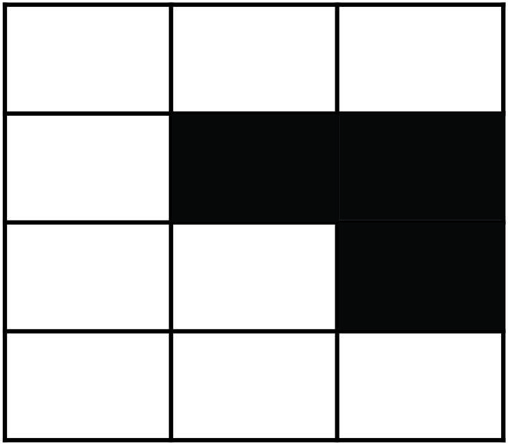
Correct option is C
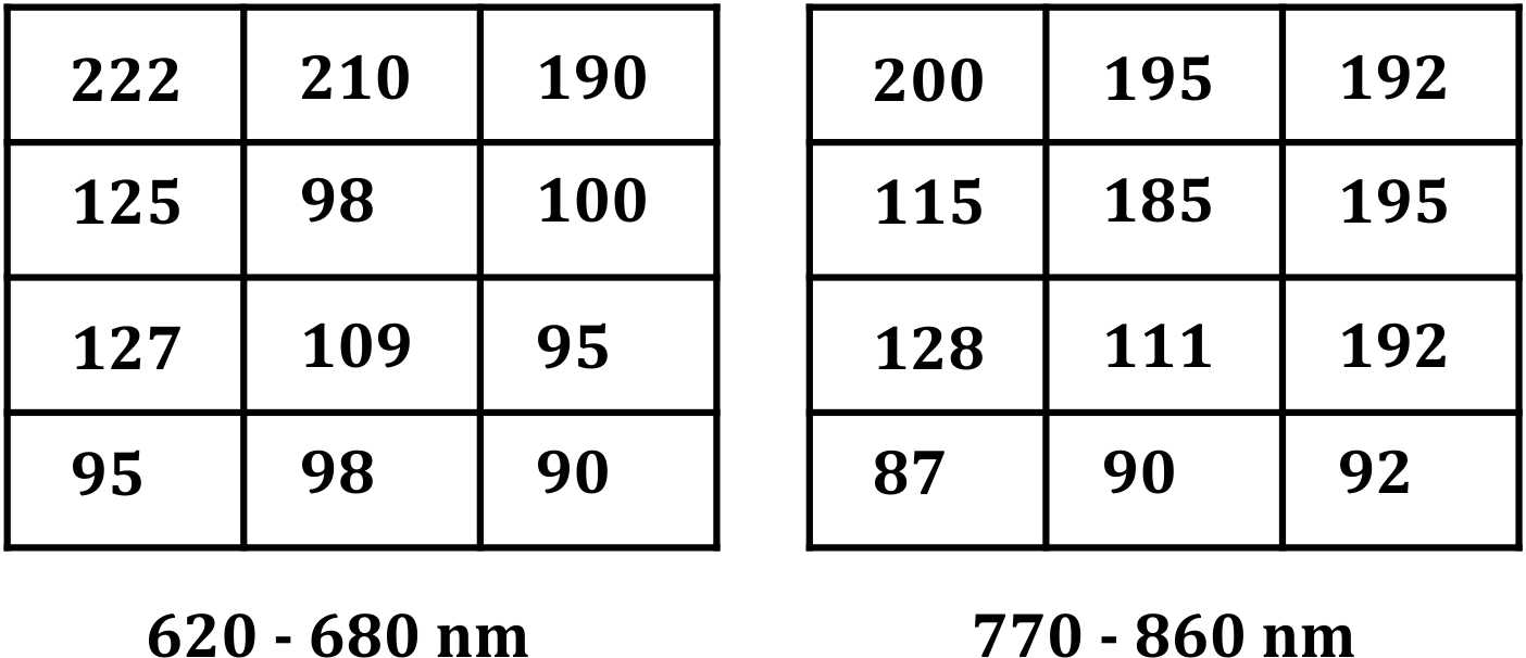
The correct answer is Option 3, based on the calculation of Normalized Difference Vegetation Index (NDVI) which is a widely used method to identify vegetated areas from satellite imagery.
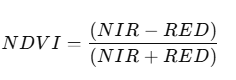
Where:
- NIR = 770–860 nm band values
- RED = 620–680 nm band values
Interpretation:
- Higher NDVI values (closer to +1) indicate vegetation.
- NDVI > 0.2 is a typical threshold for green vegetation.
- NDVI close to zero or negative indicates non-vegetated areas (soil, water, or built-up surfaces)
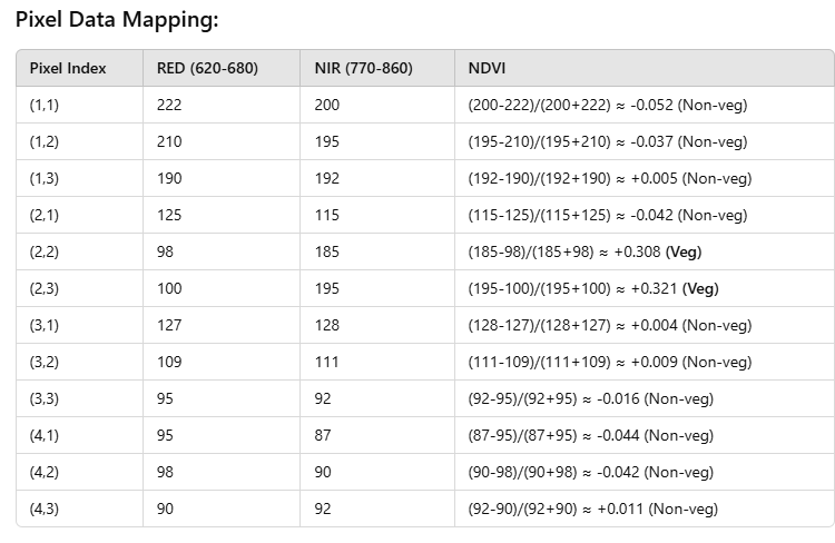
Conclusion:
Only pixels (2,2) and (2,3) have significantly positive NDVI values (>0.3), indicating vegetation presence.
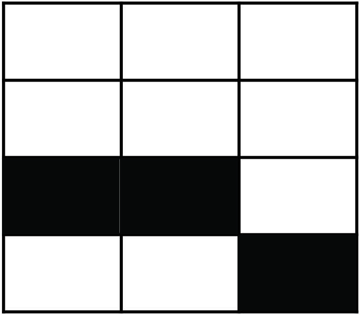
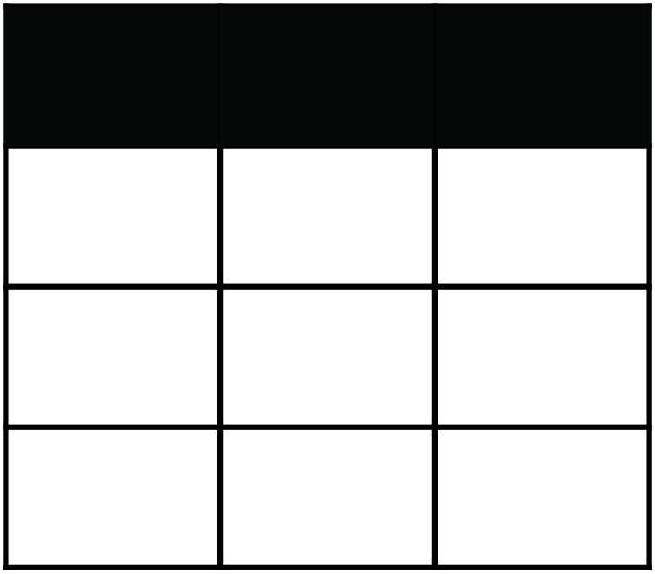
Now, look at Option 3 visual pattern — it shows these two pixels as darkened (vegetated), matching exactly with the NDVI analysis.
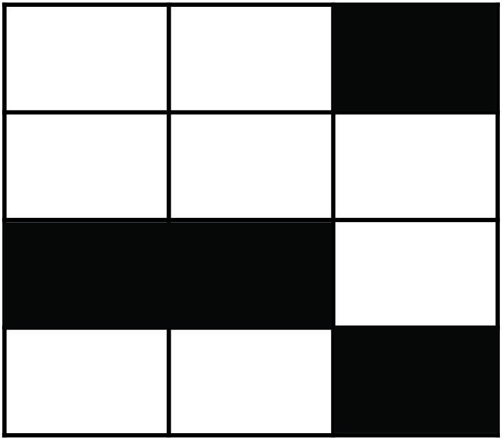
Incorrect Options:
- Option 1 and Option 2 include non-vegetated pixels, hence incorrect.
- Option 4 darkens more pixels than required, misclassifying non-vegetated ones.
